You are here: Home > Network List > TA - USArray Transportable Network (new EarthScope stations) Stations List
> Station I24A Kuemmerle Ranch, Upton, WY, USA > Earthquake Result Viewer
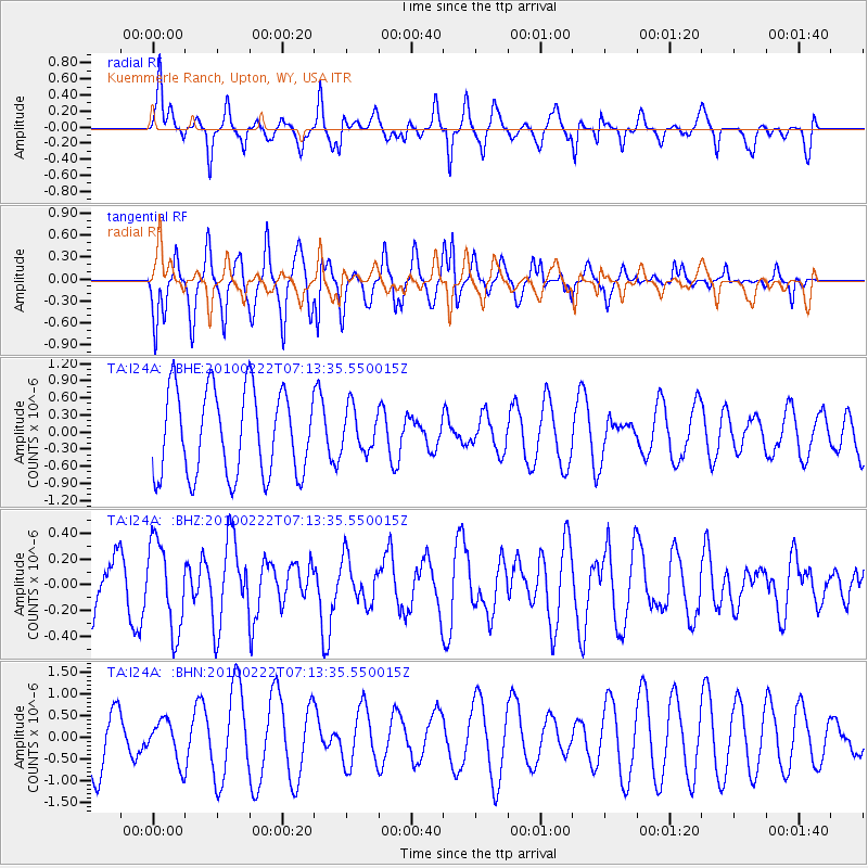
I24A Kuemmerle Ranch, Upton, WY, USA - Earthquake Result Viewer
*The percent match for this event was below the threshold and hence no stack was calculated.
| Earthquake location: |
South Of Fiji Islands |
| Earthquake latitude/longitude: |
-23.6/-176.0 |
| Earthquake time(UTC): |
2010/02/22 (053) 07:00:52 GMT |
| Earthquake Depth: |
25 km |
| Earthquake Magnitude: |
5.5 MB, 5.8 MS, 6.0 MW, 5.9 MW |
| Earthquake Catalog/Contributor: |
WHDF/NEIC |
|
| Network: |
TA USArray Transportable Network (new EarthScope stations) |
| Station: |
I24A Kuemmerle Ranch, Upton, WY, USA |
| Lat/Lon: |
43.86 N/104.63 W |
| Elevation: |
1338 m |
|
| Distance: |
93.7 deg |
| Az: |
43.395 deg |
| Baz: |
240.578 deg |
| Ray Param: |
$rayparam |
*The percent match for this event was below the threshold and hence was not used in the summary stack. |
|
| Radial Match: |
65.09081 % |
| Radial Bump: |
400 |
| Transverse Match: |
45.10993 % |
| Transverse Bump: |
390 |
| SOD ConfigId: |
307546 |
| Insert Time: |
2010-05-14 07:20:14.359 +0000 |
| GWidth: |
2.5 |
| Max Bumps: |
400 |
| Tol: |
0.001 |
|
Signal To Noise
| Channel | StoN | STA | LTA |
| TA:I24A: :BHZ:20100222T07:13:35.550015Z | 1.7485845 | 3.4033528E-7 | 1.9463472E-7 |
| TA:I24A: :BHN:20100222T07:13:35.550015Z | 0.53321254 | 4.7843406E-7 | 8.9726706E-7 |
| TA:I24A: :BHE:20100222T07:13:35.550015Z | 0.500549 | 3.737665E-7 | 7.467131E-7 |
| Arrivals |
| Ps | |
| PpPs | |
| PsPs/PpSs | |


