You are here: Home > Network List > TA - USArray Transportable Network (new EarthScope stations) Stations List
> Station G29A Hoven, SD, USA > Earthquake Result Viewer
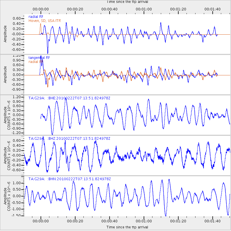
G29A Hoven, SD, USA - Earthquake Result Viewer
*The percent match for this event was below the threshold and hence no stack was calculated.
| Earthquake location: |
South Of Fiji Islands |
| Earthquake latitude/longitude: |
-23.6/-176.0 |
| Earthquake time(UTC): |
2010/02/22 (053) 07:00:52 GMT |
| Earthquake Depth: |
25 km |
| Earthquake Magnitude: |
5.5 MB, 5.8 MS, 6.0 MW, 5.9 MW |
| Earthquake Catalog/Contributor: |
WHDF/NEIC |
|
| Network: |
TA USArray Transportable Network (new EarthScope stations) |
| Station: |
G29A Hoven, SD, USA |
| Lat/Lon: |
45.19 N/99.92 W |
| Elevation: |
588 m |
|
| Distance: |
97.3 deg |
| Az: |
43.787 deg |
| Baz: |
243.829 deg |
| Ray Param: |
$rayparam |
*The percent match for this event was below the threshold and hence was not used in the summary stack. |
|
| Radial Match: |
71.116135 % |
| Radial Bump: |
400 |
| Transverse Match: |
52.652576 % |
| Transverse Bump: |
400 |
| SOD ConfigId: |
307546 |
| Insert Time: |
2010-05-14 07:22:56.737 +0000 |
| GWidth: |
2.5 |
| Max Bumps: |
400 |
| Tol: |
0.001 |
|
Signal To Noise
| Channel | StoN | STA | LTA |
| TA:G29A: :BHZ:20100222T07:13:51.824978Z | 1.4437034 | 4.6171863E-7 | 3.1981543E-7 |
| TA:G29A: :BHN:20100222T07:13:51.824978Z | 0.28329864 | 1.9256774E-7 | 6.797341E-7 |
| TA:G29A: :BHE:20100222T07:13:51.824978Z | 0.86365616 | 4.963244E-7 | 5.7467827E-7 |
| Arrivals |
| Ps | |
| PpPs | |
| PsPs/PpSs | |


