You are here: Home > Network List > TA - USArray Transportable Network (new EarthScope stations) Stations List
> Station 535A Dale, TX, USA > Earthquake Result Viewer
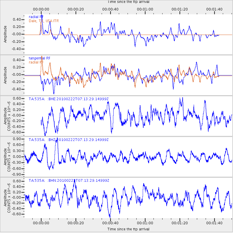
535A Dale, TX, USA - Earthquake Result Viewer
*The percent match for this event was below the threshold and hence no stack was calculated.
| Earthquake location: |
South Of Fiji Islands |
| Earthquake latitude/longitude: |
-23.6/-176.0 |
| Earthquake time(UTC): |
2010/02/22 (053) 07:00:52 GMT |
| Earthquake Depth: |
25 km |
| Earthquake Magnitude: |
5.5 MB, 5.8 MS, 6.0 MW, 5.9 MW |
| Earthquake Catalog/Contributor: |
WHDF/NEIC |
|
| Network: |
TA USArray Transportable Network (new EarthScope stations) |
| Station: |
535A Dale, TX, USA |
| Lat/Lon: |
30.03 N/97.57 W |
| Elevation: |
170 m |
|
| Distance: |
92.3 deg |
| Az: |
58.253 deg |
| Baz: |
244.064 deg |
| Ray Param: |
$rayparam |
*The percent match for this event was below the threshold and hence was not used in the summary stack. |
|
| Radial Match: |
50.982067 % |
| Radial Bump: |
400 |
| Transverse Match: |
52.174465 % |
| Transverse Bump: |
400 |
| SOD ConfigId: |
307546 |
| Insert Time: |
2010-05-14 07:24:28.494 +0000 |
| GWidth: |
2.5 |
| Max Bumps: |
400 |
| Tol: |
0.001 |
|
Signal To Noise
| Channel | StoN | STA | LTA |
| TA:535A: :BHZ:20100222T07:13:29.14999Z | 3.3271468 | 3.8282087E-7 | 1.15059805E-7 |
| TA:535A: :BHN:20100222T07:13:29.14999Z | 0.9266837 | 1.8157313E-7 | 1.9593861E-7 |
| TA:535A: :BHE:20100222T07:13:29.14999Z | 0.65145123 | 1.7066336E-7 | 2.6197412E-7 |
| Arrivals |
| Ps | |
| PpPs | |
| PsPs/PpSs | |


