You are here: Home > Network List > US - United States National Seismic Network Stations List
> Station MNTX Cornudas Mountains, Texas, USA > Earthquake Result Viewer
MNTX Cornudas Mountains, Texas, USA - Earthquake Result Viewer
*The percent match for this event was below the threshold and hence no stack was calculated.
| Earthquake location: |
South Of Fiji Islands |
| Earthquake latitude/longitude: |
-23.6/-176.0 |
| Earthquake time(UTC): |
2010/02/22 (053) 07:00:52 GMT |
| Earthquake Depth: |
25 km |
| Earthquake Magnitude: |
5.5 MB, 5.8 MS, 6.0 MW, 5.9 MW |
| Earthquake Catalog/Contributor: |
WHDF/NEIC |
|
| Network: |
US United States National Seismic Network |
| Station: |
MNTX Cornudas Mountains, Texas, USA |
| Lat/Lon: |
31.70 N/105.38 W |
| Elevation: |
404 m |
|
| Distance: |
87.1 deg |
| Az: |
53.639 deg |
| Baz: |
240.046 deg |
| Ray Param: |
$rayparam |
*The percent match for this event was below the threshold and hence was not used in the summary stack. |
|
| Radial Match: |
73.10004 % |
| Radial Bump: |
225 |
| Transverse Match: |
53.52992 % |
| Transverse Bump: |
307 |
| SOD ConfigId: |
307546 |
| Insert Time: |
2010-05-14 07:25:40.241 +0000 |
| GWidth: |
2.5 |
| Max Bumps: |
400 |
| Tol: |
0.001 |
|
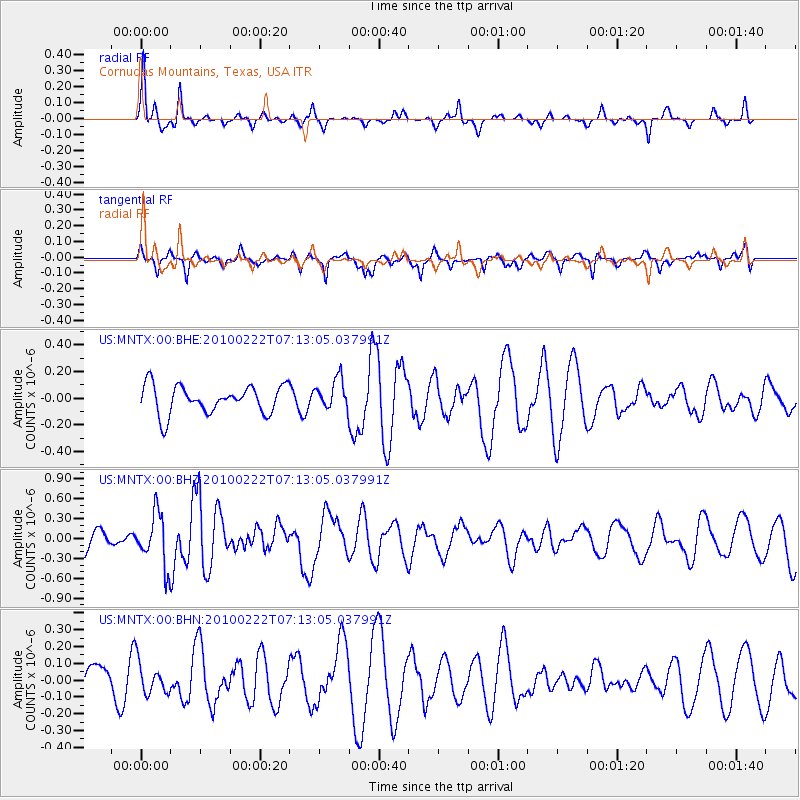
Signal To Noise
| Channel | StoN | STA | LTA |
| US:MNTX:00:BHZ:20100222T07:13:05.037991Z | 2.7578878 | 3.9265194E-7 | 1.4237415E-7 |
| US:MNTX:00:BHN:20100222T07:13:05.037991Z | 0.734626 | 9.3244616E-8 | 1.2692801E-7 |
| US:MNTX:00:BHE:20100222T07:13:05.037991Z | 1.0916167 | 1.1514577E-7 | 1.0548187E-7 |
| Arrivals |
| Ps | |
| PpPs | |
| PsPs/PpSs | |


