You are here: Home > Network List > IW - Intermountain West Stations List
> Station PLID Pearl Lake, Idaho, USA > Earthquake Result Viewer
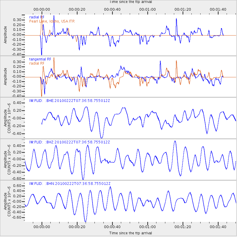
PLID Pearl Lake, Idaho, USA - Earthquake Result Viewer
*The percent match for this event was below the threshold and hence no stack was calculated.
| Earthquake location: |
Tonga Islands Region |
| Earthquake latitude/longitude: |
-23.7/-175.9 |
| Earthquake time(UTC): |
2010/02/22 (053) 07:24:45 GMT |
| Earthquake Depth: |
35 km |
| Earthquake Magnitude: |
5.6 MW, 5.2 MB |
| Earthquake Catalog/Contributor: |
WHDF/NEIC |
|
| Network: |
IW Intermountain West |
| Station: |
PLID Pearl Lake, Idaho, USA |
| Lat/Lon: |
45.09 N/116.00 W |
| Elevation: |
2164 m |
|
| Distance: |
87.5 deg |
| Az: |
37.846 deg |
| Baz: |
232.531 deg |
| Ray Param: |
$rayparam |
*The percent match for this event was below the threshold and hence was not used in the summary stack. |
|
| Radial Match: |
50.426556 % |
| Radial Bump: |
400 |
| Transverse Match: |
55.6869 % |
| Transverse Bump: |
400 |
| SOD ConfigId: |
307546 |
| Insert Time: |
2010-05-14 07:30:24.199 +0000 |
| GWidth: |
2.5 |
| Max Bumps: |
400 |
| Tol: |
0.001 |
|
Signal To Noise
| Channel | StoN | STA | LTA |
| IW:PLID: :BHZ:20100222T07:36:58.755012Z | 1.135819 | 1.9870338E-7 | 1.7494283E-7 |
| IW:PLID: :BHN:20100222T07:36:58.755012Z | 0.8972571 | 1.41848E-7 | 1.580907E-7 |
| IW:PLID: :BHE:20100222T07:36:58.755012Z | 2.7079234 | 3.0800896E-7 | 1.13743596E-7 |
| Arrivals |
| Ps | |
| PpPs | |
| PsPs/PpSs | |


