You are here: Home > Network List > TA - USArray Transportable Network (new EarthScope stations) Stations List
> Station 532A Rocksprings, TX, USA > Earthquake Result Viewer
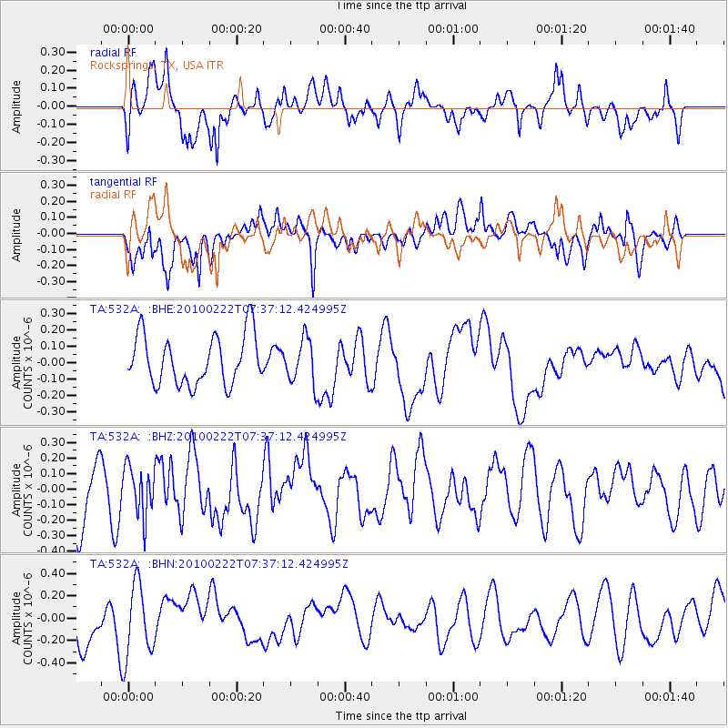
532A Rocksprings, TX, USA - Earthquake Result Viewer
*The percent match for this event was below the threshold and hence no stack was calculated.
| Earthquake location: |
Tonga Islands Region |
| Earthquake latitude/longitude: |
-23.7/-175.9 |
| Earthquake time(UTC): |
2010/02/22 (053) 07:24:45 GMT |
| Earthquake Depth: |
35 km |
| Earthquake Magnitude: |
5.6 MW, 5.2 MB |
| Earthquake Catalog/Contributor: |
WHDF/NEIC |
|
| Network: |
TA USArray Transportable Network (new EarthScope stations) |
| Station: |
532A Rocksprings, TX, USA |
| Lat/Lon: |
30.13 N/99.90 W |
| Elevation: |
703 m |
|
| Distance: |
90.5 deg |
| Az: |
57.214 deg |
| Baz: |
242.778 deg |
| Ray Param: |
$rayparam |
*The percent match for this event was below the threshold and hence was not used in the summary stack. |
|
| Radial Match: |
50.890366 % |
| Radial Bump: |
400 |
| Transverse Match: |
64.80021 % |
| Transverse Bump: |
400 |
| SOD ConfigId: |
307546 |
| Insert Time: |
2010-05-14 07:33:29.762 +0000 |
| GWidth: |
2.5 |
| Max Bumps: |
400 |
| Tol: |
0.001 |
|
Signal To Noise
| Channel | StoN | STA | LTA |
| TA:532A: :BHZ:20100222T07:37:12.424995Z | 0.83866704 | 1.5545535E-7 | 1.8536004E-7 |
| TA:532A: :BHN:20100222T07:37:12.424995Z | 2.4229612 | 3.2291356E-7 | 1.3327228E-7 |
| TA:532A: :BHE:20100222T07:37:12.424995Z | 0.91475004 | 1.376953E-7 | 1.5052778E-7 |
| Arrivals |
| Ps | |
| PpPs | |
| PsPs/PpSs | |


