You are here: Home > Network List > TA - USArray Transportable Network (new EarthScope stations) Stations List
> Station 635A Leesville, TX, USA > Earthquake Result Viewer
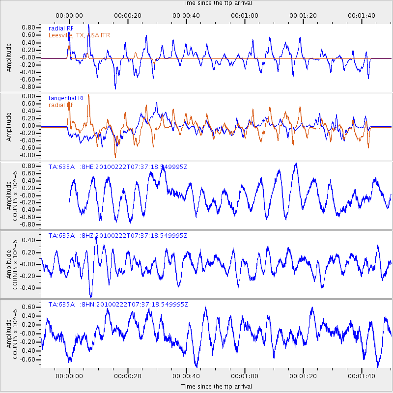
635A Leesville, TX, USA - Earthquake Result Viewer
*The percent match for this event was below the threshold and hence no stack was calculated.
| Earthquake location: |
Tonga Islands Region |
| Earthquake latitude/longitude: |
-23.7/-175.9 |
| Earthquake time(UTC): |
2010/02/22 (053) 07:24:45 GMT |
| Earthquake Depth: |
35 km |
| Earthquake Magnitude: |
5.6 MW, 5.2 MB |
| Earthquake Catalog/Contributor: |
WHDF/NEIC |
|
| Network: |
TA USArray Transportable Network (new EarthScope stations) |
| Station: |
635A Leesville, TX, USA |
| Lat/Lon: |
29.39 N/97.77 W |
| Elevation: |
119 m |
|
| Distance: |
91.8 deg |
| Az: |
58.706 deg |
| Baz: |
243.802 deg |
| Ray Param: |
$rayparam |
*The percent match for this event was below the threshold and hence was not used in the summary stack. |
|
| Radial Match: |
65.44518 % |
| Radial Bump: |
400 |
| Transverse Match: |
46.47836 % |
| Transverse Bump: |
400 |
| SOD ConfigId: |
307546 |
| Insert Time: |
2010-05-14 07:35:08.836 +0000 |
| GWidth: |
2.5 |
| Max Bumps: |
400 |
| Tol: |
0.001 |
|
Signal To Noise
| Channel | StoN | STA | LTA |
| TA:635A: :BHZ:20100222T07:37:18.549995Z | 1.1053185 | 1.18389366E-7 | 1.0710882E-7 |
| TA:635A: :BHN:20100222T07:37:18.549995Z | 1.494338 | 3.9348487E-7 | 2.633172E-7 |
| TA:635A: :BHE:20100222T07:37:18.549995Z | 1.521434 | 5.4473065E-7 | 3.5803765E-7 |
| Arrivals |
| Ps | |
| PpPs | |
| PsPs/PpSs | |


