You are here: Home > Network List > US - United States National Seismic Network Stations List
> Station OGNE Ogallala, Nebraska, USA > Earthquake Result Viewer
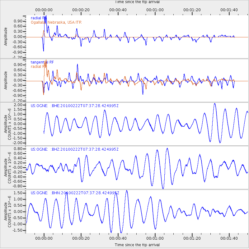
OGNE Ogallala, Nebraska, USA - Earthquake Result Viewer
*The percent match for this event was below the threshold and hence no stack was calculated.
| Earthquake location: |
Tonga Islands Region |
| Earthquake latitude/longitude: |
-23.7/-175.9 |
| Earthquake time(UTC): |
2010/02/22 (053) 07:24:45 GMT |
| Earthquake Depth: |
35 km |
| Earthquake Magnitude: |
5.6 MW, 5.2 MB |
| Earthquake Catalog/Contributor: |
WHDF/NEIC |
|
| Network: |
US United States National Seismic Network |
| Station: |
OGNE Ogallala, Nebraska, USA |
| Lat/Lon: |
40.95 N/102.03 W |
| Elevation: |
0.0 m |
|
| Distance: |
93.9 deg |
| Az: |
46.841 deg |
| Baz: |
241.94 deg |
| Ray Param: |
$rayparam |
*The percent match for this event was below the threshold and hence was not used in the summary stack. |
|
| Radial Match: |
71.30978 % |
| Radial Bump: |
400 |
| Transverse Match: |
42.674152 % |
| Transverse Bump: |
386 |
| SOD ConfigId: |
307546 |
| Insert Time: |
2010-05-14 07:36:08.745 +0000 |
| GWidth: |
2.5 |
| Max Bumps: |
400 |
| Tol: |
0.001 |
|
Signal To Noise
| Channel | StoN | STA | LTA |
| US:OGNE: :BHZ:20100222T07:37:28.424995Z | 0.37367886 | 7.907668E-8 | 2.1161667E-7 |
| US:OGNE: :BHN:20100222T07:37:28.424995Z | 0.8690557 | 8.178807E-7 | 9.4111425E-7 |
| US:OGNE: :BHE:20100222T07:37:28.424995Z | 1.6296488 | 9.672821E-7 | 5.9355244E-7 |
| Arrivals |
| Ps | |
| PpPs | |
| PsPs/PpSs | |


