You are here: Home > Network List > US - United States National Seismic Network Stations List
> Station LONY Lake Ozonia, New York, USA > Earthquake Result Viewer
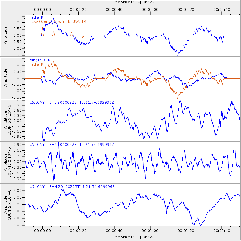
LONY Lake Ozonia, New York, USA - Earthquake Result Viewer
*The percent match for this event was below the threshold and hence no stack was calculated.
| Earthquake location: |
Mexico-Guatemala Border Region |
| Earthquake latitude/longitude: |
16.0/-91.3 |
| Earthquake time(UTC): |
2010/02/23 (054) 15:16:00 GMT |
| Earthquake Depth: |
10 km |
| Earthquake Magnitude: |
5.5 MW, 5.2 MS, 5.3 MB, 5.5 MW |
| Earthquake Catalog/Contributor: |
WHDF/NEIC |
|
| Network: |
US United States National Seismic Network |
| Station: |
LONY Lake Ozonia, New York, USA |
| Lat/Lon: |
44.62 N/74.58 W |
| Elevation: |
440 m |
|
| Distance: |
31.9 deg |
| Az: |
22.851 deg |
| Baz: |
211.539 deg |
| Ray Param: |
$rayparam |
*The percent match for this event was below the threshold and hence was not used in the summary stack. |
|
| Radial Match: |
23.5731 % |
| Radial Bump: |
400 |
| Transverse Match: |
35.68132 % |
| Transverse Bump: |
400 |
| SOD ConfigId: |
307546 |
| Insert Time: |
2010-05-14 07:44:22.700 +0000 |
| GWidth: |
2.5 |
| Max Bumps: |
400 |
| Tol: |
0.001 |
|
Signal To Noise
| Channel | StoN | STA | LTA |
| US:LONY: :BHZ:20100223T15:21:54.699996Z | 0.99785674 | 2.905188E-7 | 2.9114278E-7 |
| US:LONY: :BHN:20100223T15:21:54.699996Z | 2.4341667 | 9.0229395E-7 | 3.7067878E-7 |
| US:LONY: :BHE:20100223T15:21:54.699996Z | 0.6034623 | 3.1334602E-7 | 5.1924707E-7 |
| Arrivals |
| Ps | |
| PpPs | |
| PsPs/PpSs | |


