You are here: Home > Network List > GS - US Geological Survey Networks Stations List
> Station DEC06 Boomer > Earthquake Result Viewer
DEC06 Boomer - Earthquake Result Viewer
*The percent match for this event was below the threshold and hence no stack was calculated.
| Earthquake location: |
Kuril Islands |
| Earthquake latitude/longitude: |
49.1/156.4 |
| Earthquake time(UTC): |
2018/10/10 (283) 23:16:04 GMT |
| Earthquake Depth: |
33 km |
| Earthquake Magnitude: |
6.8 Mi |
| Earthquake Catalog/Contributor: |
NEIC PDE/at |
|
| Network: |
GS US Geological Survey Networks |
| Station: |
DEC06 Boomer |
| Lat/Lon: |
39.90 N/88.95 W |
| Elevation: |
215 m |
|
| Distance: |
74.3 deg |
| Az: |
46.576 deg |
| Baz: |
321.648 deg |
| Ray Param: |
$rayparam |
*The percent match for this event was below the threshold and hence was not used in the summary stack. |
|
| Radial Match: |
42.409515 % |
| Radial Bump: |
400 |
| Transverse Match: |
44.15027 % |
| Transverse Bump: |
400 |
| SOD ConfigId: |
3045211 |
| Insert Time: |
2018-10-24 23:27:41.983 +0000 |
| GWidth: |
2.5 |
| Max Bumps: |
400 |
| Tol: |
0.001 |
|
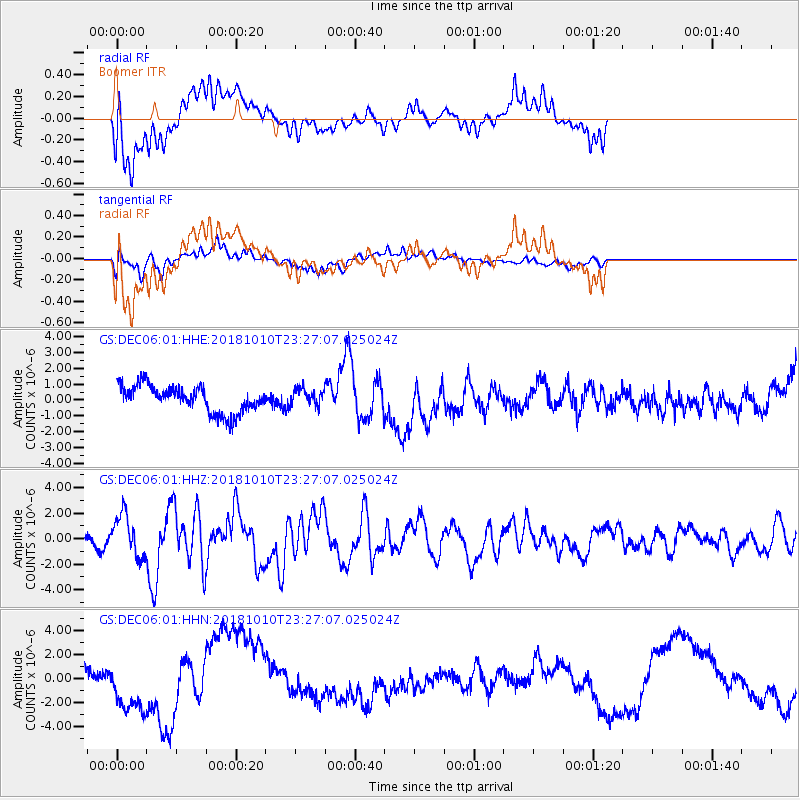
Signal To Noise
| Channel | StoN | STA | LTA |
| GS:DEC06:01:HHZ:20181010T23:27:07.025024Z | 2.2134938 | 1.6420214E-6 | 7.418234E-7 |
| GS:DEC06:01:HHN:20181010T23:27:07.025024Z | 1.2299125 | 1.8000103E-6 | 1.4635272E-6 |
| GS:DEC06:01:HHE:20181010T23:27:07.025024Z | 0.65186083 | 5.490559E-7 | 8.422901E-7 |
| Arrivals |
| Ps | |
| PpPs | |
| PsPs/PpSs | |


