You are here: Home > Network List > G - GEOSCOPE Stations List
> Station ATD Arta Cave - Arta, Republic of Djibouti > Earthquake Result Viewer
ATD Arta Cave - Arta, Republic of Djibouti - Earthquake Result Viewer

| Earthquake location: |
Northern Sumatra, Indonesia |
| Earthquake latitude/longitude: |
0.9/98.8 |
| Earthquake time(UTC): |
2023/04/03 (093) 14:59:42 GMT |
| Earthquake Depth: |
85 km |
| Earthquake Magnitude: |
6.1 mww |
| Earthquake Catalog/Contributor: |
NEIC PDE/us |
|
| Network: |
G GEOSCOPE |
| Station: |
ATD Arta Cave - Arta, Republic of Djibouti |
| Lat/Lon: |
11.53 N/42.85 E |
| Elevation: |
610 m |
|
| Distance: |
56.6 deg |
| Az: |
283.174 deg |
| Baz: |
96.608 deg |
| Ray Param: |
0.06381987 |
| Estimated Moho Depth: |
57.5 km |
| Estimated Crust Vp/Vs: |
2.10 |
| Assumed Crust Vp: |
6.375 km/s |
| Estimated Crust Vs: |
3.043 km/s |
| Estimated Crust Poisson's Ratio: |
0.35 |
|
| Radial Match: |
95.343315 % |
| Radial Bump: |
362 |
| Transverse Match: |
81.792755 % |
| Transverse Bump: |
400 |
| SOD ConfigId: |
30536071 |
| Insert Time: |
2023-04-17 15:05:59.345 +0000 |
| GWidth: |
2.5 |
| Max Bumps: |
400 |
| Tol: |
0.001 |
|
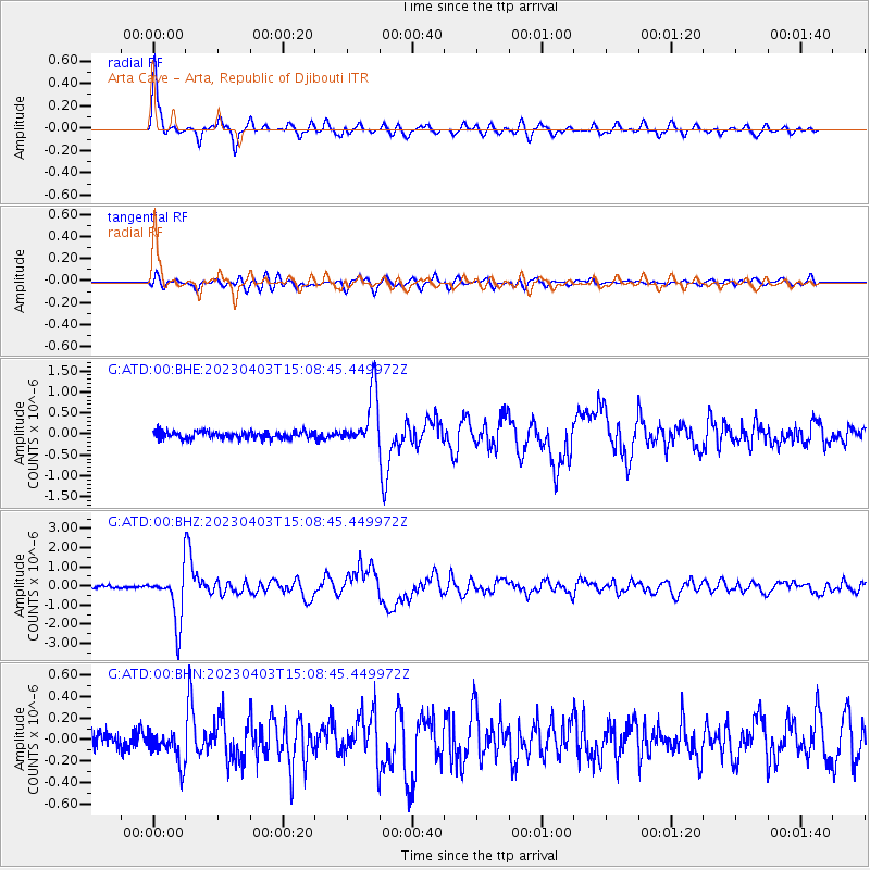
Signal To Noise
| Channel | StoN | STA | LTA |
| G:ATD:00:BHZ:20230403T15:08:45.449972Z | 19.349249 | 1.325597E-6 | 6.850897E-8 |
| G:ATD:00:BHN:20230403T15:08:45.449972Z | 2.2434032 | 1.5367178E-7 | 6.84994E-8 |
| G:ATD:00:BHE:20230403T15:08:45.449972Z | 7.6813545 | 6.513622E-7 | 8.479783E-8 |
| Arrivals |
| Ps | 10 SECOND |
| PpPs | 27 SECOND |
| PsPs/PpSs | 37 SECOND |


