You are here: Home > Network List > IW - Intermountain West Stations List
> Station PLID Pearl Lake, Idaho, USA > Earthquake Result Viewer
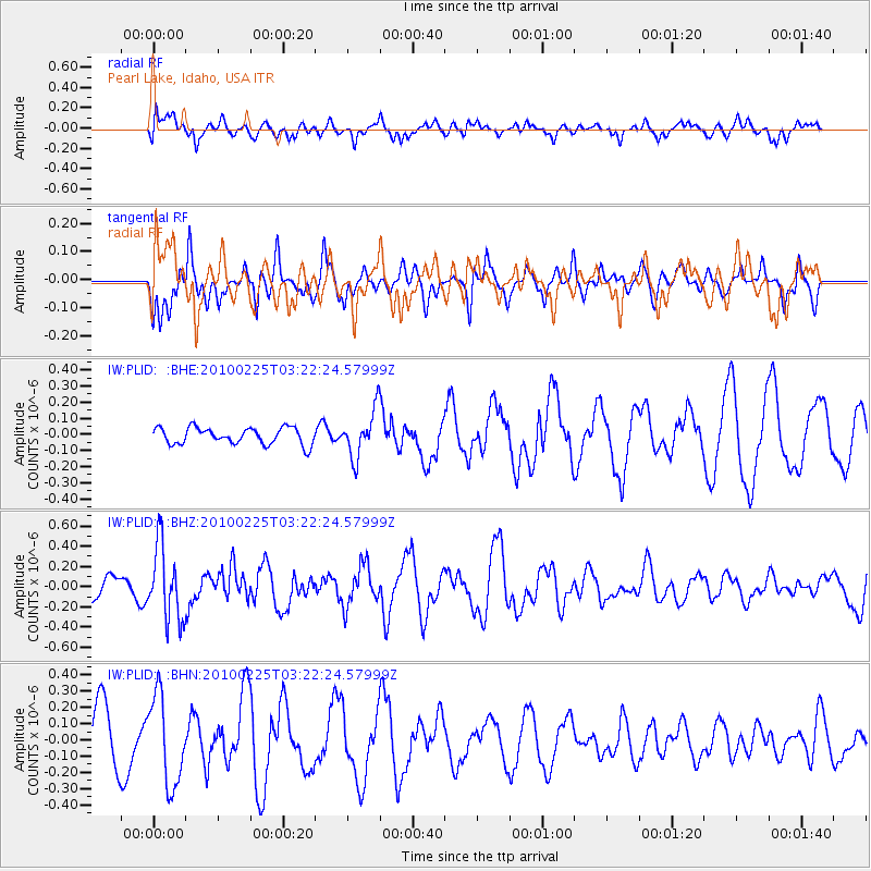
PLID Pearl Lake, Idaho, USA - Earthquake Result Viewer
*The percent match for this event was below the threshold and hence no stack was calculated.
| Earthquake location: |
Near Coast Of Nicaragua |
| Earthquake latitude/longitude: |
11.2/-86.1 |
| Earthquake time(UTC): |
2010/02/25 (056) 03:15:03 GMT |
| Earthquake Depth: |
25 km |
| Earthquake Magnitude: |
5.6 MW, 5.3 MS, 5.4 MB, 5.6 MW |
| Earthquake Catalog/Contributor: |
WHDF/NEIC |
|
| Network: |
IW Intermountain West |
| Station: |
PLID Pearl Lake, Idaho, USA |
| Lat/Lon: |
45.09 N/116.00 W |
| Elevation: |
2164 m |
|
| Distance: |
42.4 deg |
| Az: |
328.434 deg |
| Baz: |
133.52 deg |
| Ray Param: |
$rayparam |
*The percent match for this event was below the threshold and hence was not used in the summary stack. |
|
| Radial Match: |
45.336845 % |
| Radial Bump: |
400 |
| Transverse Match: |
60.469 % |
| Transverse Bump: |
320 |
| SOD ConfigId: |
307546 |
| Insert Time: |
2010-05-14 07:52:30.335 +0000 |
| GWidth: |
2.5 |
| Max Bumps: |
400 |
| Tol: |
0.001 |
|
Signal To Noise
| Channel | StoN | STA | LTA |
| IW:PLID: :BHZ:20100225T03:22:24.57999Z | 3.741917 | 3.61577E-7 | 9.662882E-8 |
| IW:PLID: :BHN:20100225T03:22:24.57999Z | 1.3867422 | 2.7362634E-7 | 1.9731594E-7 |
| IW:PLID: :BHE:20100225T03:22:24.57999Z | 2.8177383 | 1.4450649E-7 | 5.1284566E-8 |
| Arrivals |
| Ps | |
| PpPs | |
| PsPs/PpSs | |


