You are here: Home > Network List > TA - USArray Transportable Network (new EarthScope stations) Stations List
> Station Z14A Wintersburg, AZ, USA > Earthquake Result Viewer
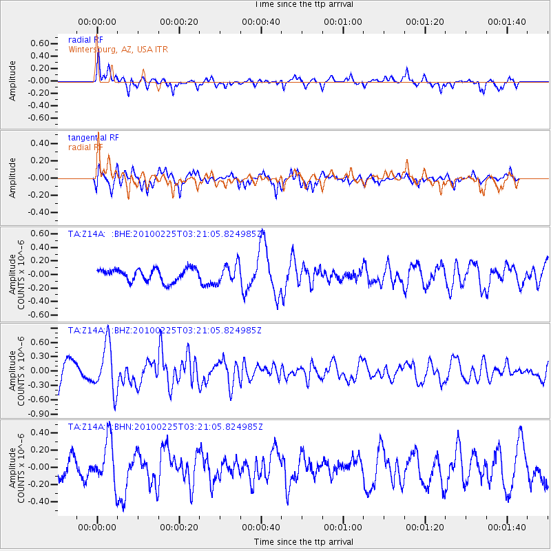
Z14A Wintersburg, AZ, USA - Earthquake Result Viewer
*The percent match for this event was below the threshold and hence no stack was calculated.
| Earthquake location: |
Near Coast Of Nicaragua |
| Earthquake latitude/longitude: |
11.2/-86.1 |
| Earthquake time(UTC): |
2010/02/25 (056) 03:15:03 GMT |
| Earthquake Depth: |
25 km |
| Earthquake Magnitude: |
5.6 MW, 5.3 MS, 5.4 MB, 5.6 MW |
| Earthquake Catalog/Contributor: |
WHDF/NEIC |
|
| Network: |
TA USArray Transportable Network (new EarthScope stations) |
| Station: |
Z14A Wintersburg, AZ, USA |
| Lat/Lon: |
33.36 N/112.95 W |
| Elevation: |
298 m |
|
| Distance: |
33.0 deg |
| Az: |
316.166 deg |
| Baz: |
125.703 deg |
| Ray Param: |
$rayparam |
*The percent match for this event was below the threshold and hence was not used in the summary stack. |
|
| Radial Match: |
68.47092 % |
| Radial Bump: |
367 |
| Transverse Match: |
69.809784 % |
| Transverse Bump: |
400 |
| SOD ConfigId: |
307546 |
| Insert Time: |
2010-05-14 07:53:21.265 +0000 |
| GWidth: |
2.5 |
| Max Bumps: |
400 |
| Tol: |
0.001 |
|
Signal To Noise
| Channel | StoN | STA | LTA |
| TA:Z14A: :BHZ:20100225T03:21:05.824985Z | 2.5265074 | 5.0963433E-7 | 2.0171495E-7 |
| TA:Z14A: :BHN:20100225T03:21:05.824985Z | 1.575626 | 2.6707605E-7 | 1.695047E-7 |
| TA:Z14A: :BHE:20100225T03:21:05.824985Z | 1.5076027 | 1.3834321E-7 | 9.176371E-8 |
| Arrivals |
| Ps | |
| PpPs | |
| PsPs/PpSs | |


