You are here: Home > Network List > CN - Canadian National Seismograph Network Stations List
> Station INK INUVIK, NT > Earthquake Result Viewer
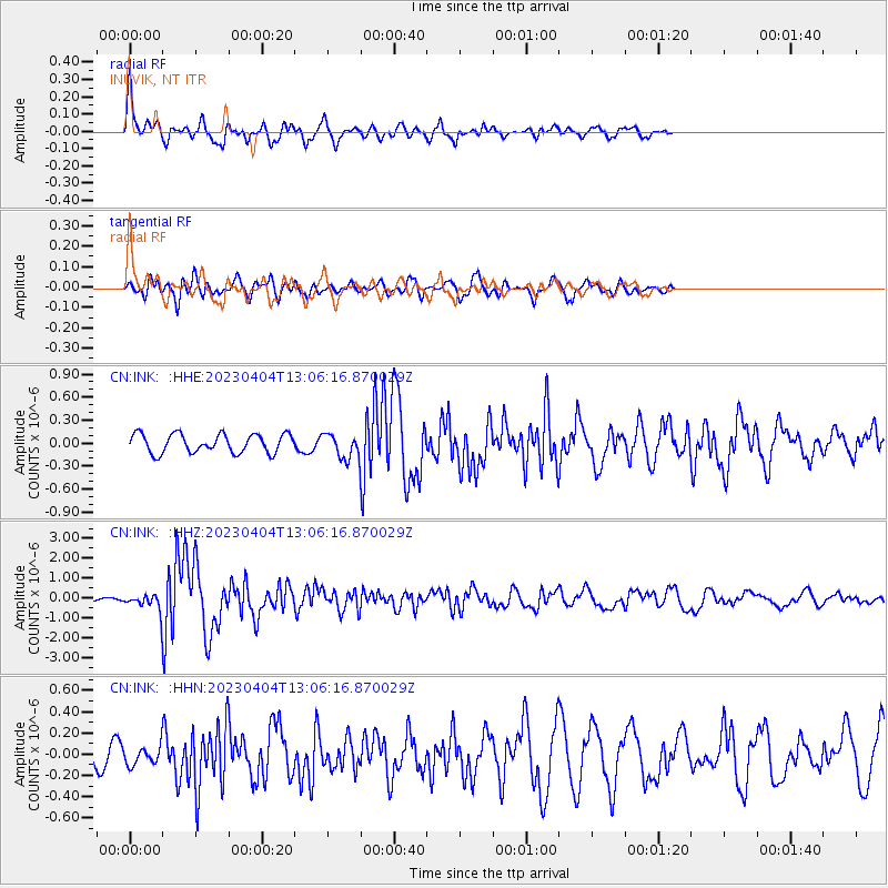
INK INUVIK, NT - Earthquake Result Viewer
*The percent match for this event was below the threshold and hence no stack was calculated.
| Earthquake location: |
Philippine Islands Region |
| Earthquake latitude/longitude: |
13.8/125.5 |
| Earthquake time(UTC): |
2023/04/04 (094) 12:54:32 GMT |
| Earthquake Depth: |
15 km |
| Earthquake Magnitude: |
6.2 mww |
| Earthquake Catalog/Contributor: |
NEIC PDE/us |
|
| Network: |
CN Canadian National Seismograph Network |
| Station: |
INK INUVIK, NT |
| Lat/Lon: |
68.31 N/133.53 W |
| Elevation: |
44 m |
|
| Distance: |
81.3 deg |
| Az: |
21.67 deg |
| Baz: |
285.184 deg |
| Ray Param: |
$rayparam |
*The percent match for this event was below the threshold and hence was not used in the summary stack. |
|
| Radial Match: |
78.525955 % |
| Radial Bump: |
400 |
| Transverse Match: |
70.99204 % |
| Transverse Bump: |
400 |
| SOD ConfigId: |
30536071 |
| Insert Time: |
2023-04-18 13:03:51.810 +0000 |
| GWidth: |
2.5 |
| Max Bumps: |
400 |
| Tol: |
0.001 |
|
Signal To Noise
| Channel | StoN | STA | LTA |
| CN:INK: :HHZ:20230404T13:06:16.870029Z | 3.1768293 | 3.228499E-7 | 1.01626455E-7 |
| CN:INK: :HHN:20230404T13:06:16.870029Z | 1.000667 | 7.940702E-8 | 7.9354095E-8 |
| CN:INK: :HHE:20230404T13:06:16.870029Z | 1.2809019 | 1.5689528E-7 | 1.2248813E-7 |
| Arrivals |
| Ps | |
| PpPs | |
| PsPs/PpSs | |


