You are here: Home > Network List > TA - USArray Transportable Network (new EarthScope stations) Stations List
> Station D22A Cohagen, MT, USA > Earthquake Result Viewer
D22A Cohagen, MT, USA - Earthquake Result Viewer
*The percent match for this event was below the threshold and hence no stack was calculated.
| Earthquake location: |
Near Coast Of Nicaragua |
| Earthquake latitude/longitude: |
11.2/-86.1 |
| Earthquake time(UTC): |
2010/02/25 (056) 03:15:03 GMT |
| Earthquake Depth: |
25 km |
| Earthquake Magnitude: |
5.6 MW, 5.3 MS, 5.4 MB, 5.6 MW |
| Earthquake Catalog/Contributor: |
WHDF/NEIC |
|
| Network: |
TA USArray Transportable Network (new EarthScope stations) |
| Station: |
D22A Cohagen, MT, USA |
| Lat/Lon: |
47.15 N/106.18 W |
| Elevation: |
791 m |
|
| Distance: |
39.7 deg |
| Az: |
338.485 deg |
| Baz: |
148.179 deg |
| Ray Param: |
$rayparam |
*The percent match for this event was below the threshold and hence was not used in the summary stack. |
|
| Radial Match: |
44.1481 % |
| Radial Bump: |
379 |
| Transverse Match: |
48.962746 % |
| Transverse Bump: |
326 |
| SOD ConfigId: |
307546 |
| Insert Time: |
2010-05-14 07:58:55.224 +0000 |
| GWidth: |
2.5 |
| Max Bumps: |
400 |
| Tol: |
0.001 |
|
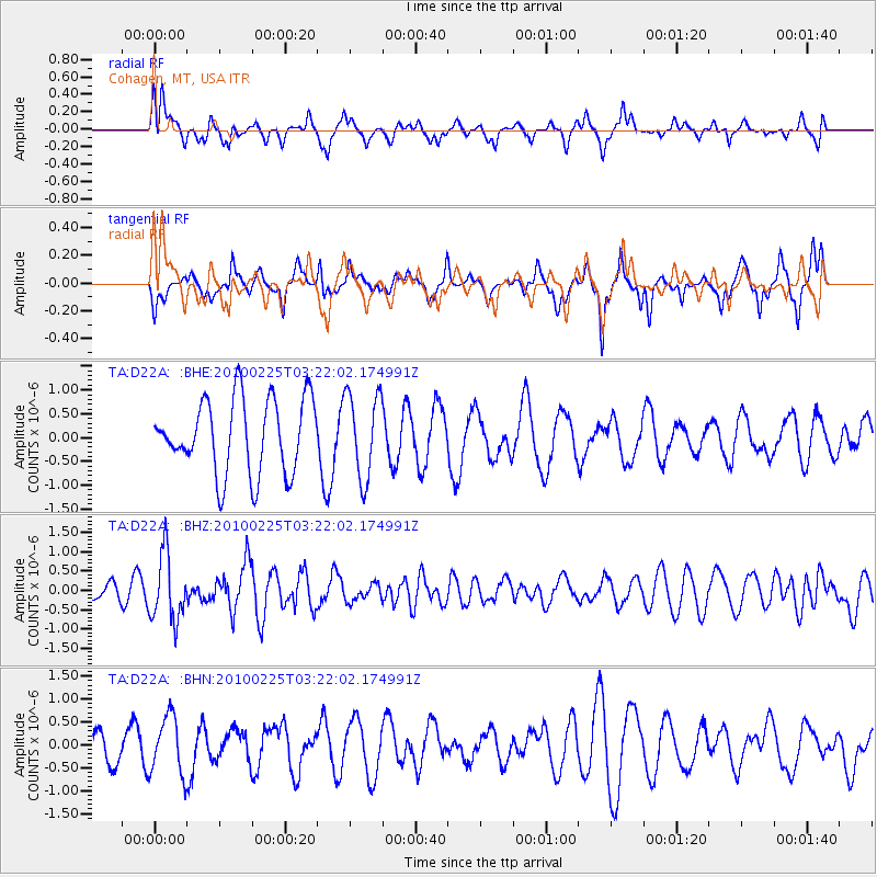
Signal To Noise
| Channel | StoN | STA | LTA |
| TA:D22A: :BHZ:20100225T03:22:02.174991Z | 4.3937116 | 8.607321E-7 | 1.959009E-7 |
| TA:D22A: :BHN:20100225T03:22:02.174991Z | 0.87510026 | 6.373308E-7 | 7.282946E-7 |
| TA:D22A: :BHE:20100225T03:22:02.174991Z | 1.1551399 | 8.9299255E-7 | 7.7306004E-7 |
| Arrivals |
| Ps | |
| PpPs | |
| PsPs/PpSs | |


