You are here: Home > Network List > TA - USArray Transportable Network (new EarthScope stations) Stations List
> Station A21A Bergtoll Ranch, Theony, MT, USA > Earthquake Result Viewer
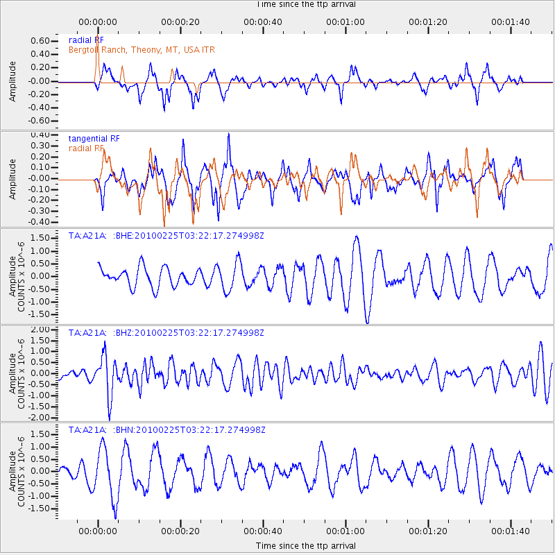
A21A Bergtoll Ranch, Theony, MT, USA - Earthquake Result Viewer
*The percent match for this event was below the threshold and hence no stack was calculated.
| Earthquake location: |
Near Coast Of Nicaragua |
| Earthquake latitude/longitude: |
11.2/-86.1 |
| Earthquake time(UTC): |
2010/02/25 (056) 03:15:03 GMT |
| Earthquake Depth: |
25 km |
| Earthquake Magnitude: |
5.6 MW, 5.3 MS, 5.4 MB, 5.6 MW |
| Earthquake Catalog/Contributor: |
WHDF/NEIC |
|
| Network: |
TA USArray Transportable Network (new EarthScope stations) |
| Station: |
A21A Bergtoll Ranch, Theony, MT, USA |
| Lat/Lon: |
48.99 N/106.93 W |
| Elevation: |
779 m |
|
| Distance: |
41.5 deg |
| Az: |
339.324 deg |
| Baz: |
148.263 deg |
| Ray Param: |
$rayparam |
*The percent match for this event was below the threshold and hence was not used in the summary stack. |
|
| Radial Match: |
57.79238 % |
| Radial Bump: |
333 |
| Transverse Match: |
65.73434 % |
| Transverse Bump: |
347 |
| SOD ConfigId: |
307546 |
| Insert Time: |
2010-05-14 07:59:38.196 +0000 |
| GWidth: |
2.5 |
| Max Bumps: |
400 |
| Tol: |
0.001 |
|
Signal To Noise
| Channel | StoN | STA | LTA |
| TA:A21A: :BHZ:20100225T03:22:17.274998Z | 4.2188697 | 9.012713E-7 | 2.1362861E-7 |
| TA:A21A: :BHN:20100225T03:22:17.274998Z | 3.420235 | 1.053913E-6 | 3.0814056E-7 |
| TA:A21A: :BHE:20100225T03:22:17.274998Z | 1.6081471 | 5.737314E-7 | 3.5676553E-7 |
| Arrivals |
| Ps | |
| PpPs | |
| PsPs/PpSs | |


