You are here: Home > Network List > TA - USArray Transportable Network (new EarthScope stations) Stations List
> Station D24A Glendive, MT, USA > Earthquake Result Viewer
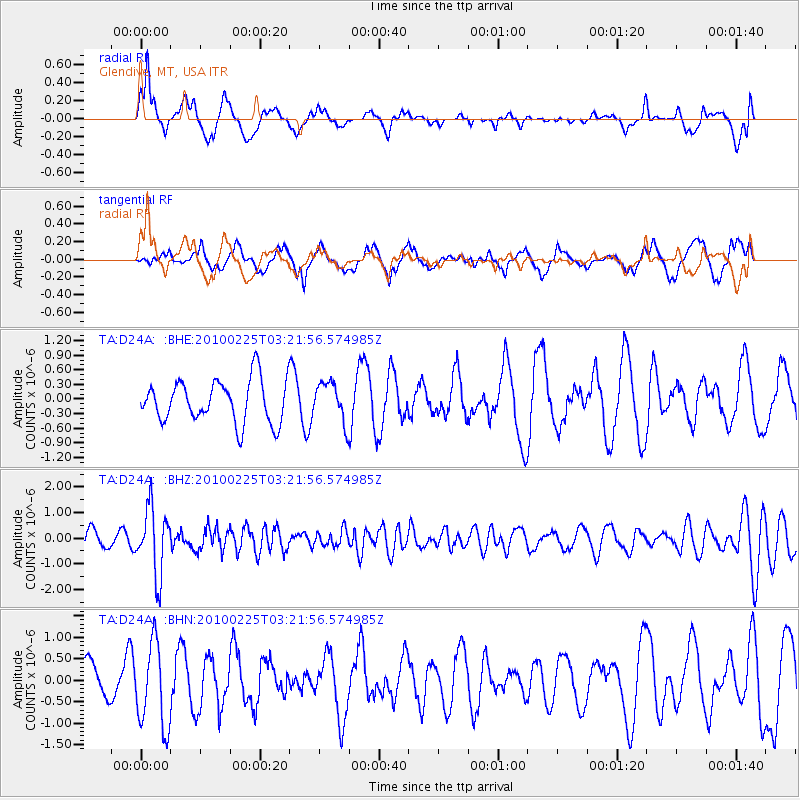
D24A Glendive, MT, USA - Earthquake Result Viewer
*The percent match for this event was below the threshold and hence no stack was calculated.
| Earthquake location: |
Near Coast Of Nicaragua |
| Earthquake latitude/longitude: |
11.2/-86.1 |
| Earthquake time(UTC): |
2010/02/25 (056) 03:15:03 GMT |
| Earthquake Depth: |
25 km |
| Earthquake Magnitude: |
5.6 MW, 5.3 MS, 5.4 MB, 5.6 MW |
| Earthquake Catalog/Contributor: |
WHDF/NEIC |
|
| Network: |
TA USArray Transportable Network (new EarthScope stations) |
| Station: |
D24A Glendive, MT, USA |
| Lat/Lon: |
47.12 N/104.33 W |
| Elevation: |
766 m |
|
| Distance: |
39.0 deg |
| Az: |
340.178 deg |
| Baz: |
150.842 deg |
| Ray Param: |
$rayparam |
*The percent match for this event was below the threshold and hence was not used in the summary stack. |
|
| Radial Match: |
58.262 % |
| Radial Bump: |
400 |
| Transverse Match: |
45.997444 % |
| Transverse Bump: |
400 |
| SOD ConfigId: |
307546 |
| Insert Time: |
2010-05-14 07:59:51.638 +0000 |
| GWidth: |
2.5 |
| Max Bumps: |
400 |
| Tol: |
0.001 |
|
Signal To Noise
| Channel | StoN | STA | LTA |
| TA:D24A: :BHZ:20100225T03:21:56.574985Z | 3.0162838 | 1.2844416E-6 | 4.2583582E-7 |
| TA:D24A: :BHN:20100225T03:21:56.574985Z | 2.3027968 | 9.893628E-7 | 4.2963526E-7 |
| TA:D24A: :BHE:20100225T03:21:56.574985Z | 0.9334145 | 4.054493E-7 | 4.343722E-7 |
| Arrivals |
| Ps | |
| PpPs | |
| PsPs/PpSs | |


