You are here: Home > Network List > TA - USArray Transportable Network (new EarthScope stations) Stations List
> Station I24A Kuemmerle Ranch, Upton, WY, USA > Earthquake Result Viewer
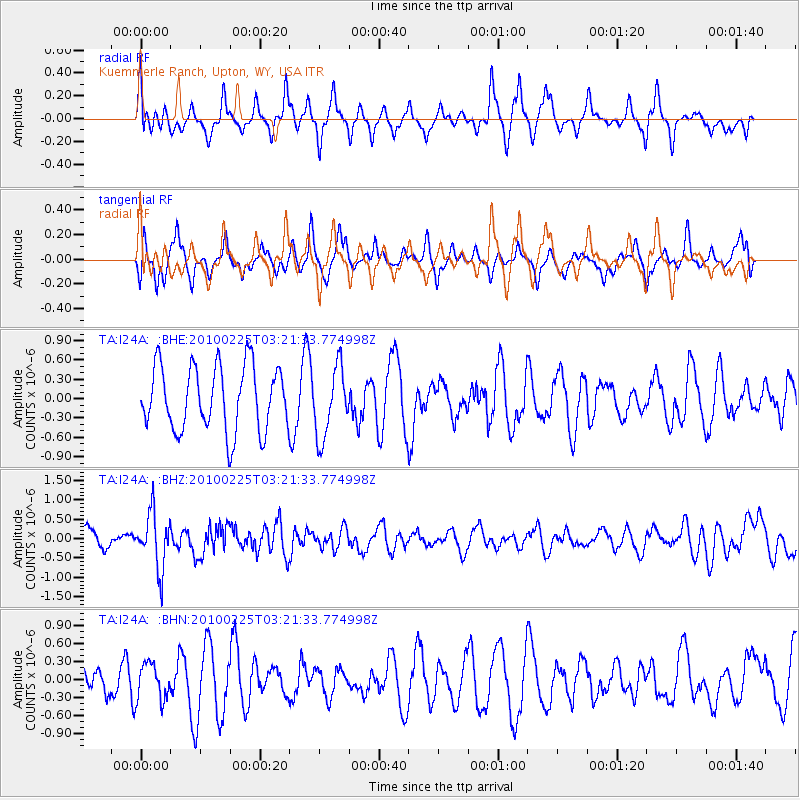
I24A Kuemmerle Ranch, Upton, WY, USA - Earthquake Result Viewer
*The percent match for this event was below the threshold and hence no stack was calculated.
| Earthquake location: |
Near Coast Of Nicaragua |
| Earthquake latitude/longitude: |
11.2/-86.1 |
| Earthquake time(UTC): |
2010/02/25 (056) 03:15:03 GMT |
| Earthquake Depth: |
25 km |
| Earthquake Magnitude: |
5.6 MW, 5.3 MS, 5.4 MB, 5.6 MW |
| Earthquake Catalog/Contributor: |
WHDF/NEIC |
|
| Network: |
TA USArray Transportable Network (new EarthScope stations) |
| Station: |
I24A Kuemmerle Ranch, Upton, WY, USA |
| Lat/Lon: |
43.86 N/104.63 W |
| Elevation: |
1338 m |
|
| Distance: |
36.3 deg |
| Az: |
337.178 deg |
| Baz: |
148.253 deg |
| Ray Param: |
$rayparam |
*The percent match for this event was below the threshold and hence was not used in the summary stack. |
|
| Radial Match: |
67.857895 % |
| Radial Bump: |
400 |
| Transverse Match: |
58.46893 % |
| Transverse Bump: |
362 |
| SOD ConfigId: |
307546 |
| Insert Time: |
2010-05-14 08:00:35.139 +0000 |
| GWidth: |
2.5 |
| Max Bumps: |
400 |
| Tol: |
0.001 |
|
Signal To Noise
| Channel | StoN | STA | LTA |
| TA:I24A: :BHZ:20100225T03:21:33.774998Z | 2.949059 | 7.140699E-7 | 2.4213483E-7 |
| TA:I24A: :BHN:20100225T03:21:33.774998Z | 0.8917099 | 3.0055028E-7 | 3.3704939E-7 |
| TA:I24A: :BHE:20100225T03:21:33.774998Z | 1.0788579 | 5.406255E-7 | 5.0110907E-7 |
| Arrivals |
| Ps | |
| PpPs | |
| PsPs/PpSs | |


