You are here: Home > Network List > US - United States National Seismic Network Stations List
> Station AMTX Amarillo, Texas, USA > Earthquake Result Viewer
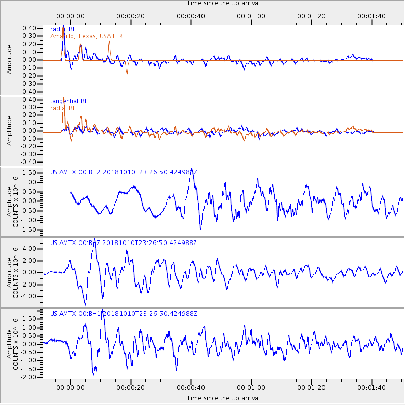
AMTX Amarillo, Texas, USA - Earthquake Result Viewer
*The percent match for this event was below the threshold and hence no stack was calculated.
| Earthquake location: |
Kuril Islands |
| Earthquake latitude/longitude: |
49.1/156.4 |
| Earthquake time(UTC): |
2018/10/10 (283) 23:16:04 GMT |
| Earthquake Depth: |
33 km |
| Earthquake Magnitude: |
6.8 Mi |
| Earthquake Catalog/Contributor: |
NEIC PDE/at |
|
| Network: |
US United States National Seismic Network |
| Station: |
AMTX Amarillo, Texas, USA |
| Lat/Lon: |
34.53 N/101.41 W |
| Elevation: |
1010 m |
|
| Distance: |
71.9 deg |
| Az: |
58.102 deg |
| Baz: |
317.478 deg |
| Ray Param: |
$rayparam |
*The percent match for this event was below the threshold and hence was not used in the summary stack. |
|
| Radial Match: |
79.03116 % |
| Radial Bump: |
400 |
| Transverse Match: |
60.159058 % |
| Transverse Bump: |
400 |
| SOD ConfigId: |
3045211 |
| Insert Time: |
2018-10-24 23:32:33.253 +0000 |
| GWidth: |
2.5 |
| Max Bumps: |
400 |
| Tol: |
0.001 |
|
Signal To Noise
| Channel | StoN | STA | LTA |
| US:AMTX:00:BHZ:20181010T23:26:50.424988Z | 8.269048 | 2.427767E-6 | 2.935969E-7 |
| US:AMTX:00:BH1:20181010T23:26:50.424988Z | 3.380467 | 6.235538E-7 | 1.8445789E-7 |
| US:AMTX:00:BH2:20181010T23:26:50.424988Z | 0.846795 | 3.695782E-7 | 4.3644351E-7 |
| Arrivals |
| Ps | |
| PpPs | |
| PsPs/PpSs | |


