You are here: Home > Network List > US - United States National Seismic Network Stations List
> Station CBKS Cedar Bluff, Kansas, USA > Earthquake Result Viewer
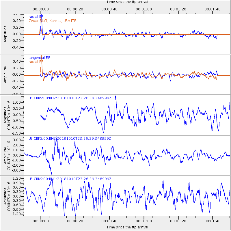
CBKS Cedar Bluff, Kansas, USA - Earthquake Result Viewer
*The percent match for this event was below the threshold and hence no stack was calculated.
| Earthquake location: |
Kuril Islands |
| Earthquake latitude/longitude: |
49.1/156.4 |
| Earthquake time(UTC): |
2018/10/10 (283) 23:16:04 GMT |
| Earthquake Depth: |
33 km |
| Earthquake Magnitude: |
6.8 Mi |
| Earthquake Catalog/Contributor: |
NEIC PDE/at |
|
| Network: |
US United States National Seismic Network |
| Station: |
CBKS Cedar Bluff, Kansas, USA |
| Lat/Lon: |
38.81 N/99.74 W |
| Elevation: |
677 m |
|
| Distance: |
69.7 deg |
| Az: |
53.986 deg |
| Baz: |
317.117 deg |
| Ray Param: |
$rayparam |
*The percent match for this event was below the threshold and hence was not used in the summary stack. |
|
| Radial Match: |
79.00105 % |
| Radial Bump: |
400 |
| Transverse Match: |
75.32955 % |
| Transverse Bump: |
400 |
| SOD ConfigId: |
3045211 |
| Insert Time: |
2018-10-24 23:32:43.069 +0000 |
| GWidth: |
2.5 |
| Max Bumps: |
400 |
| Tol: |
0.001 |
|
Signal To Noise
| Channel | StoN | STA | LTA |
| US:CBKS:00:BHZ:20181010T23:26:39.348999Z | 2.9774134 | 8.557194E-7 | 2.8740362E-7 |
| US:CBKS:00:BH1:20181010T23:26:39.348999Z | 2.270246 | 4.918076E-7 | 2.1663186E-7 |
| US:CBKS:00:BH2:20181010T23:26:39.348999Z | 1.1788429 | 5.1493214E-7 | 4.3681155E-7 |
| Arrivals |
| Ps | |
| PpPs | |
| PsPs/PpSs | |


