You are here: Home > Network List > US - United States National Seismic Network Stations List
> Station EGMT Eagleton, Montana, USA > Earthquake Result Viewer
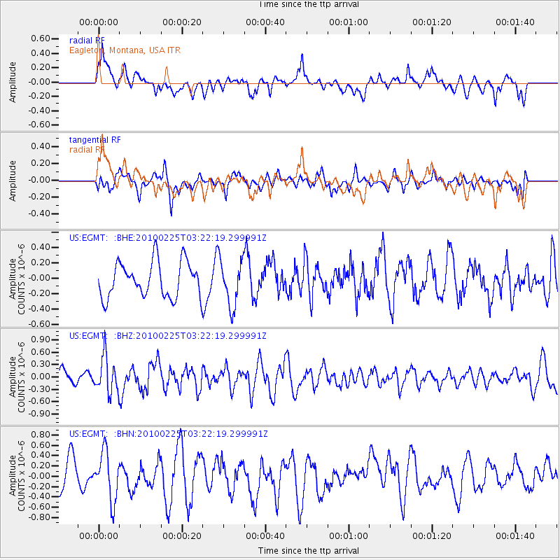
EGMT Eagleton, Montana, USA - Earthquake Result Viewer
*The percent match for this event was below the threshold and hence no stack was calculated.
| Earthquake location: |
Near Coast Of Nicaragua |
| Earthquake latitude/longitude: |
11.2/-86.1 |
| Earthquake time(UTC): |
2010/02/25 (056) 03:15:03 GMT |
| Earthquake Depth: |
25 km |
| Earthquake Magnitude: |
5.6 MW, 5.3 MS, 5.4 MB, 5.6 MW |
| Earthquake Catalog/Contributor: |
WHDF/NEIC |
|
| Network: |
US United States National Seismic Network |
| Station: |
EGMT Eagleton, Montana, USA |
| Lat/Lon: |
48.02 N/109.75 W |
| Elevation: |
1055 m |
|
| Distance: |
41.7 deg |
| Az: |
336.159 deg |
| Baz: |
143.784 deg |
| Ray Param: |
$rayparam |
*The percent match for this event was below the threshold and hence was not used in the summary stack. |
|
| Radial Match: |
58.595963 % |
| Radial Bump: |
400 |
| Transverse Match: |
42.359016 % |
| Transverse Bump: |
400 |
| SOD ConfigId: |
307546 |
| Insert Time: |
2010-05-14 08:12:58.028 +0000 |
| GWidth: |
2.5 |
| Max Bumps: |
400 |
| Tol: |
0.001 |
|
Signal To Noise
| Channel | StoN | STA | LTA |
| US:EGMT: :BHZ:20100225T03:22:19.299991Z | 1.8524593 | 4.4915038E-7 | 2.4246165E-7 |
| US:EGMT: :BHN:20100225T03:22:19.299991Z | 1.4841498 | 4.8032746E-7 | 3.2363812E-7 |
| US:EGMT: :BHE:20100225T03:22:19.299991Z | 1.2794691 | 2.952363E-7 | 2.3074907E-7 |
| Arrivals |
| Ps | |
| PpPs | |
| PsPs/PpSs | |


