You are here: Home > Network List > US - United States National Seismic Network Stations List
> Station EGMT Eagleton, Montana, USA > Earthquake Result Viewer
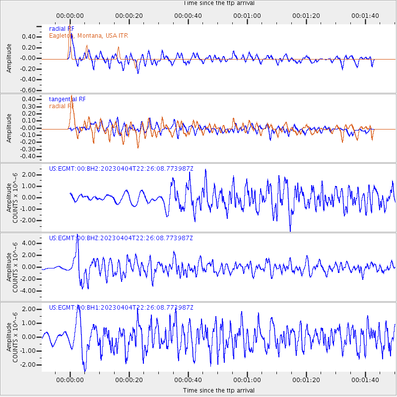
EGMT Eagleton, Montana, USA - Earthquake Result Viewer
*The percent match for this event was below the threshold and hence no stack was calculated.
| Earthquake location: |
South Of Panama |
| Earthquake latitude/longitude: |
7.6/-82.3 |
| Earthquake time(UTC): |
2023/04/04 (094) 22:18:12 GMT |
| Earthquake Depth: |
10 km |
| Earthquake Magnitude: |
6.3 mww |
| Earthquake Catalog/Contributor: |
NEIC PDE/at |
|
| Network: |
US United States National Seismic Network |
| Station: |
EGMT Eagleton, Montana, USA |
| Lat/Lon: |
48.02 N/109.75 W |
| Elevation: |
1055 m |
|
| Distance: |
46.5 deg |
| Az: |
334.784 deg |
| Baz: |
141.011 deg |
| Ray Param: |
$rayparam |
*The percent match for this event was below the threshold and hence was not used in the summary stack. |
|
| Radial Match: |
72.91532 % |
| Radial Bump: |
400 |
| Transverse Match: |
71.45531 % |
| Transverse Bump: |
400 |
| SOD ConfigId: |
30536071 |
| Insert Time: |
2023-04-18 22:52:50.938 +0000 |
| GWidth: |
2.5 |
| Max Bumps: |
400 |
| Tol: |
0.001 |
|
Signal To Noise
| Channel | StoN | STA | LTA |
| US:EGMT:00:BHZ:20230404T22:26:08.773987Z | 16.36094 | 2.4598228E-6 | 1.5034726E-7 |
| US:EGMT:00:BH1:20230404T22:26:08.773987Z | 5.3635535 | 1.2857186E-6 | 2.3971396E-7 |
| US:EGMT:00:BH2:20230404T22:26:08.773987Z | 2.5440643 | 8.67142E-7 | 3.4084908E-7 |
| Arrivals |
| Ps | |
| PpPs | |
| PsPs/PpSs | |


