You are here: Home > Network List > US - United States National Seismic Network Stations List
> Station LAO LASA Array, Montana, USA > Earthquake Result Viewer
LAO LASA Array, Montana, USA - Earthquake Result Viewer
*The percent match for this event was below the threshold and hence no stack was calculated.
| Earthquake location: |
South Of Panama |
| Earthquake latitude/longitude: |
7.6/-82.3 |
| Earthquake time(UTC): |
2023/04/04 (094) 22:18:12 GMT |
| Earthquake Depth: |
10 km |
| Earthquake Magnitude: |
6.3 mww |
| Earthquake Catalog/Contributor: |
NEIC PDE/at |
|
| Network: |
US United States National Seismic Network |
| Station: |
LAO LASA Array, Montana, USA |
| Lat/Lon: |
46.69 N/106.22 W |
| Elevation: |
902 m |
|
| Distance: |
44.0 deg |
| Az: |
336.342 deg |
| Baz: |
144.697 deg |
| Ray Param: |
$rayparam |
*The percent match for this event was below the threshold and hence was not used in the summary stack. |
|
| Radial Match: |
59.164494 % |
| Radial Bump: |
400 |
| Transverse Match: |
50.295887 % |
| Transverse Bump: |
400 |
| SOD ConfigId: |
30536071 |
| Insert Time: |
2023-04-18 22:53:07.171 +0000 |
| GWidth: |
2.5 |
| Max Bumps: |
400 |
| Tol: |
0.001 |
|
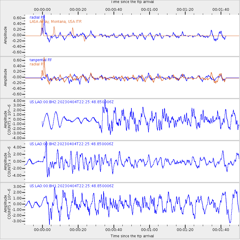
Signal To Noise
| Channel | StoN | STA | LTA |
| US:LAO:00:BHZ:20230404T22:25:48.850006Z | 5.8589177 | 2.485741E-6 | 4.2426626E-7 |
| US:LAO:00:BH1:20230404T22:25:48.850006Z | 4.517276 | 1.223792E-6 | 2.7091372E-7 |
| US:LAO:00:BH2:20230404T22:25:48.850006Z | 1.6669639 | 1.3838214E-6 | 8.301448E-7 |
| Arrivals |
| Ps | |
| PpPs | |
| PsPs/PpSs | |


