You are here: Home > Network List > TA - USArray Transportable Network (new EarthScope stations) Stations List
> Station 535A Dale, TX, USA > Earthquake Result Viewer
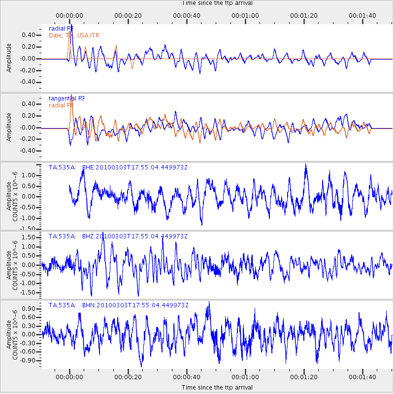
535A Dale, TX, USA - Earthquake Result Viewer
*The percent match for this event was below the threshold and hence no stack was calculated.
| Earthquake location: |
Near Coast Of Central Chile |
| Earthquake latitude/longitude: |
-36.6/-73.4 |
| Earthquake time(UTC): |
2010/03/03 (062) 17:44:25 GMT |
| Earthquake Depth: |
20 km |
| Earthquake Magnitude: |
5.6 MB, 5.9 MS, 6.1 MW, 6.1 MW |
| Earthquake Catalog/Contributor: |
WHDF/NEIC |
|
| Network: |
TA USArray Transportable Network (new EarthScope stations) |
| Station: |
535A Dale, TX, USA |
| Lat/Lon: |
30.03 N/97.57 W |
| Elevation: |
170 m |
|
| Distance: |
70.1 deg |
| Az: |
337.772 deg |
| Baz: |
159.453 deg |
| Ray Param: |
$rayparam |
*The percent match for this event was below the threshold and hence was not used in the summary stack. |
|
| Radial Match: |
64.79622 % |
| Radial Bump: |
400 |
| Transverse Match: |
59.725246 % |
| Transverse Bump: |
400 |
| SOD ConfigId: |
308276 |
| Insert Time: |
2010-06-22 15:26:15.551 +0000 |
| GWidth: |
2.5 |
| Max Bumps: |
400 |
| Tol: |
0.001 |
|
Signal To Noise
| Channel | StoN | STA | LTA |
| TA:535A: :BHZ:20100303T17:55:04.449973Z | 2.0994756 | 4.619657E-7 | 2.2003861E-7 |
| TA:535A: :BHN:20100303T17:55:04.449973Z | 1.4803649 | 3.1576485E-7 | 2.1330204E-7 |
| TA:535A: :BHE:20100303T17:55:04.449973Z | 1.355027 | 5.707171E-7 | 4.2118506E-7 |
| Arrivals |
| Ps | |
| PpPs | |
| PsPs/PpSs | |


