You are here: Home > Network List > IW - Intermountain West Stations List
> Station PLID Pearl Lake, Idaho, USA > Earthquake Result Viewer
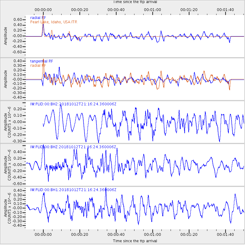
PLID Pearl Lake, Idaho, USA - Earthquake Result Viewer
*The percent match for this event was below the threshold and hence no stack was calculated.
| Earthquake location: |
Guatemala |
| Earthquake latitude/longitude: |
14.2/-91.2 |
| Earthquake time(UTC): |
2018/10/12 (285) 21:09:49 GMT |
| Earthquake Depth: |
67 km |
| Earthquake Magnitude: |
5.6 Mww |
| Earthquake Catalog/Contributor: |
NEIC PDE/us |
|
| Network: |
IW Intermountain West |
| Station: |
PLID Pearl Lake, Idaho, USA |
| Lat/Lon: |
45.09 N/116.00 W |
| Elevation: |
2164 m |
|
| Distance: |
37.3 deg |
| Az: |
330.648 deg |
| Baz: |
137.847 deg |
| Ray Param: |
$rayparam |
*The percent match for this event was below the threshold and hence was not used in the summary stack. |
|
| Radial Match: |
66.39223 % |
| Radial Bump: |
400 |
| Transverse Match: |
60.335964 % |
| Transverse Bump: |
400 |
| SOD ConfigId: |
3045211 |
| Insert Time: |
2018-10-26 21:21:32.805 +0000 |
| GWidth: |
2.5 |
| Max Bumps: |
400 |
| Tol: |
0.001 |
|
Signal To Noise
| Channel | StoN | STA | LTA |
| IW:PLID:00:BHZ:20181012T21:16:24.360006Z | 2.8878891 | 2.9769123E-7 | 1.0308264E-7 |
| IW:PLID:00:BH1:20181012T21:16:24.360006Z | 1.8206322 | 1.8222447E-7 | 1.0008857E-7 |
| IW:PLID:00:BH2:20181012T21:16:24.360006Z | 1.2232212 | 1.6094641E-7 | 1.3157589E-7 |
| Arrivals |
| Ps | |
| PpPs | |
| PsPs/PpSs | |


