You are here: Home > Network List > TA - USArray Transportable Network (new EarthScope stations) Stations List
> Station F21A Absaloka Mine, Hardin, MT, USA > Earthquake Result Viewer
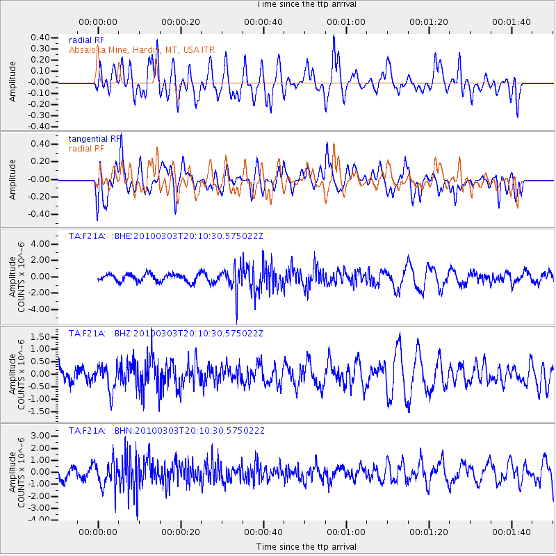
F21A Absaloka Mine, Hardin, MT, USA - Earthquake Result Viewer
*The percent match for this event was below the threshold and hence no stack was calculated.
| Earthquake location: |
Near Coast Of Central Chile |
| Earthquake latitude/longitude: |
-33.4/-71.9 |
| Earthquake time(UTC): |
2010/03/03 (062) 19:58:29 GMT |
| Earthquake Depth: |
39 km |
| Earthquake Magnitude: |
5.5 MS, 5.3 MB, 5.8 MW, 5.6 MW |
| Earthquake Catalog/Contributor: |
WHDF/NEIC |
|
| Network: |
TA USArray Transportable Network (new EarthScope stations) |
| Station: |
F21A Absaloka Mine, Hardin, MT, USA |
| Lat/Lon: |
45.82 N/107.12 W |
| Elevation: |
1026 m |
|
| Distance: |
85.1 deg |
| Az: |
336.1 deg |
| Baz: |
151.014 deg |
| Ray Param: |
$rayparam |
*The percent match for this event was below the threshold and hence was not used in the summary stack. |
|
| Radial Match: |
55.406487 % |
| Radial Bump: |
400 |
| Transverse Match: |
50.101192 % |
| Transverse Bump: |
400 |
| SOD ConfigId: |
308276 |
| Insert Time: |
2010-06-22 15:34:39.555 +0000 |
| GWidth: |
2.5 |
| Max Bumps: |
400 |
| Tol: |
0.001 |
|
Signal To Noise
| Channel | StoN | STA | LTA |
| TA:F21A: :BHZ:20100303T20:10:30.575022Z | 1.0385988 | 5.284886E-7 | 5.088477E-7 |
| TA:F21A: :BHN:20100303T20:10:30.575022Z | 1.9101133 | 1.0713227E-6 | 5.6086867E-7 |
| TA:F21A: :BHE:20100303T20:10:30.575022Z | 3.2364066 | 1.4843758E-6 | 4.5864937E-7 |
| Arrivals |
| Ps | |
| PpPs | |
| PsPs/PpSs | |


