You are here: Home > Network List > CI - Caltech Regional Seismic Network Stations List
> Station MPP McPhearson Peak > Earthquake Result Viewer
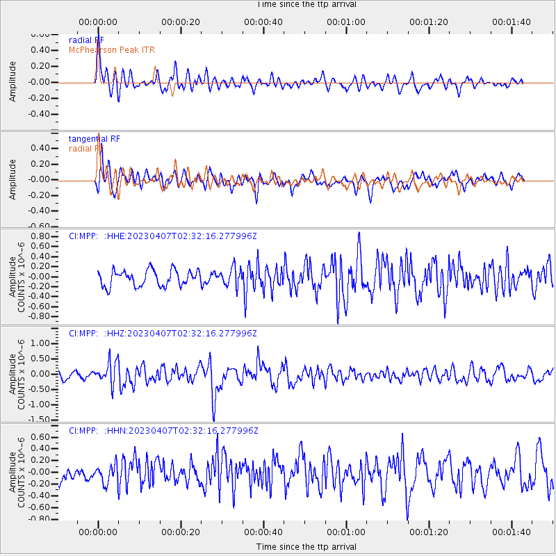
MPP McPhearson Peak - Earthquake Result Viewer
*The percent match for this event was below the threshold and hence no stack was calculated.
| Earthquake location: |
Kuril Islands |
| Earthquake latitude/longitude: |
49.9/155.3 |
| Earthquake time(UTC): |
2023/04/07 (097) 02:22:41 GMT |
| Earthquake Depth: |
86 km |
| Earthquake Magnitude: |
5.8 mww |
| Earthquake Catalog/Contributor: |
NEIC PDE/us |
|
| Network: |
CI Caltech Regional Seismic Network |
| Station: |
MPP McPhearson Peak |
| Lat/Lon: |
34.89 N/119.81 W |
| Elevation: |
1739 m |
|
| Distance: |
61.2 deg |
| Az: |
69.078 deg |
| Baz: |
312.663 deg |
| Ray Param: |
$rayparam |
*The percent match for this event was below the threshold and hence was not used in the summary stack. |
|
| Radial Match: |
71.81181 % |
| Radial Bump: |
400 |
| Transverse Match: |
53.634914 % |
| Transverse Bump: |
400 |
| SOD ConfigId: |
30536071 |
| Insert Time: |
2023-04-21 02:31:37.872 +0000 |
| GWidth: |
2.5 |
| Max Bumps: |
400 |
| Tol: |
0.001 |
|
Signal To Noise
| Channel | StoN | STA | LTA |
| CI:MPP: :HHZ:20230407T02:32:16.277996Z | 1.5796342 | 3.6943712E-7 | 2.3387511E-7 |
| CI:MPP: :HHN:20230407T02:32:16.277996Z | 0.743239 | 1.562692E-7 | 2.102543E-7 |
| CI:MPP: :HHE:20230407T02:32:16.277996Z | 1.135771 | 1.7798526E-7 | 1.5670875E-7 |
| Arrivals |
| Ps | |
| PpPs | |
| PsPs/PpSs | |


