You are here: Home > Network List > IU - Global Seismograph Network (GSN - IRIS/USGS) Stations List
> Station PMG Port Moresby, New Guinea > Earthquake Result Viewer
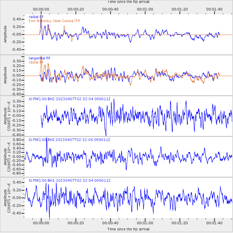
PMG Port Moresby, New Guinea - Earthquake Result Viewer
*The percent match for this event was below the threshold and hence no stack was calculated.
| Earthquake location: |
Kuril Islands |
| Earthquake latitude/longitude: |
49.9/155.3 |
| Earthquake time(UTC): |
2023/04/07 (097) 02:22:41 GMT |
| Earthquake Depth: |
86 km |
| Earthquake Magnitude: |
5.8 mww |
| Earthquake Catalog/Contributor: |
NEIC PDE/us |
|
| Network: |
IU Global Seismograph Network (GSN - IRIS/USGS) |
| Station: |
PMG Port Moresby, New Guinea |
| Lat/Lon: |
9.40 S/147.16 E |
| Elevation: |
90 m |
|
| Distance: |
59.4 deg |
| Az: |
189.295 deg |
| Baz: |
6.081 deg |
| Ray Param: |
$rayparam |
*The percent match for this event was below the threshold and hence was not used in the summary stack. |
|
| Radial Match: |
58.679134 % |
| Radial Bump: |
400 |
| Transverse Match: |
53.307465 % |
| Transverse Bump: |
400 |
| SOD ConfigId: |
30536071 |
| Insert Time: |
2023-04-21 02:38:13.418 +0000 |
| GWidth: |
2.5 |
| Max Bumps: |
400 |
| Tol: |
0.001 |
|
Signal To Noise
| Channel | StoN | STA | LTA |
| IU:PMG:00:BHZ:20230407T02:32:04.069011Z | 3.6489437 | 2.777997E-7 | 7.613154E-8 |
| IU:PMG:00:BH1:20230407T02:32:04.069011Z | 2.3309796 | 2.0276075E-7 | 8.698522E-8 |
| IU:PMG:00:BH2:20230407T02:32:04.069011Z | 1.0618734 | 8.747486E-8 | 8.237786E-8 |
| Arrivals |
| Ps | |
| PpPs | |
| PsPs/PpSs | |


