You are here: Home > Network List > IW - Intermountain West Stations List
> Station DLMT Dillon, Montana, USA > Earthquake Result Viewer
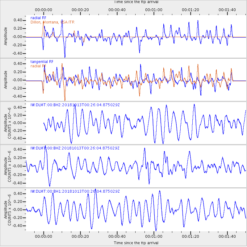
DLMT Dillon, Montana, USA - Earthquake Result Viewer
*The percent match for this event was below the threshold and hence no stack was calculated.
| Earthquake location: |
Vanuatu Islands |
| Earthquake latitude/longitude: |
-13.7/167.2 |
| Earthquake time(UTC): |
2018/10/13 (286) 00:13:46 GMT |
| Earthquake Depth: |
199 km |
| Earthquake Magnitude: |
5.7 Mww |
| Earthquake Catalog/Contributor: |
NEIC PDE/us |
|
| Network: |
IW Intermountain West |
| Station: |
DLMT Dillon, Montana, USA |
| Lat/Lon: |
45.36 N/112.60 W |
| Elevation: |
1569 m |
|
| Distance: |
92.9 deg |
| Az: |
44.072 deg |
| Baz: |
253.532 deg |
| Ray Param: |
$rayparam |
*The percent match for this event was below the threshold and hence was not used in the summary stack. |
|
| Radial Match: |
54.8621 % |
| Radial Bump: |
400 |
| Transverse Match: |
57.104523 % |
| Transverse Bump: |
400 |
| SOD ConfigId: |
3045211 |
| Insert Time: |
2018-10-27 00:20:34.021 +0000 |
| GWidth: |
2.5 |
| Max Bumps: |
400 |
| Tol: |
0.001 |
|
Signal To Noise
| Channel | StoN | STA | LTA |
| IW:DLMT:00:BHZ:20181013T00:26:04.875029Z | 1.9581196 | 2.8393274E-7 | 1.4500276E-7 |
| IW:DLMT:00:BH1:20181013T00:26:04.875029Z | 2.1541572 | 2.3671693E-7 | 1.0988842E-7 |
| IW:DLMT:00:BH2:20181013T00:26:04.875029Z | 0.83382285 | 1.7758683E-7 | 2.1297909E-7 |
| Arrivals |
| Ps | |
| PpPs | |
| PsPs/PpSs | |


