You are here: Home > Network List > UU - University of Utah Regional Network Stations List
> Station CCUT Cedar City, UT, USA > Earthquake Result Viewer
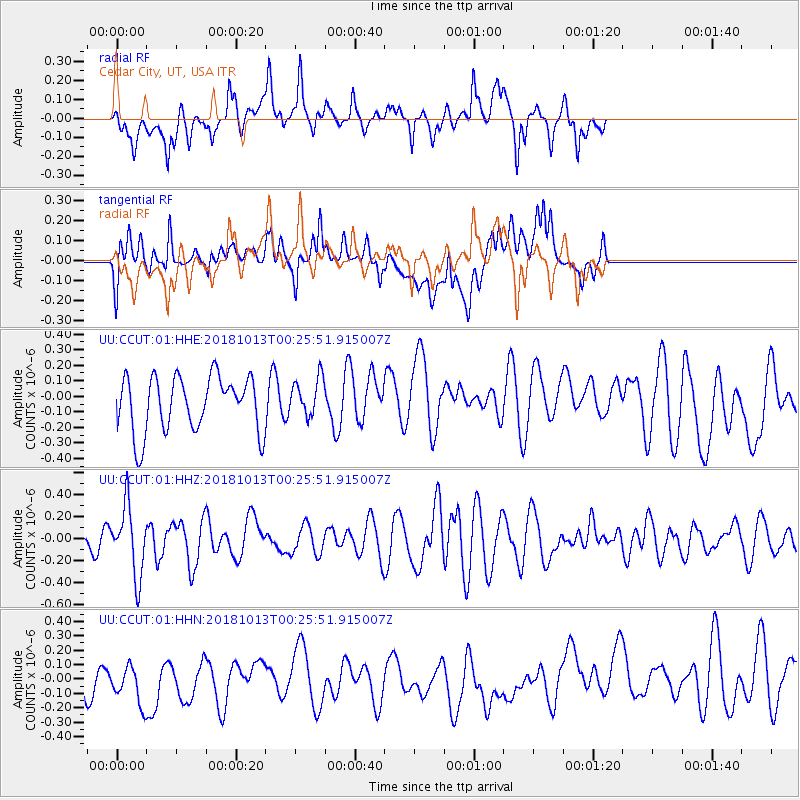
CCUT Cedar City, UT, USA - Earthquake Result Viewer
*The percent match for this event was below the threshold and hence no stack was calculated.
| Earthquake location: |
Vanuatu Islands |
| Earthquake latitude/longitude: |
-13.7/167.2 |
| Earthquake time(UTC): |
2018/10/13 (286) 00:13:46 GMT |
| Earthquake Depth: |
199 km |
| Earthquake Magnitude: |
5.7 Mww |
| Earthquake Catalog/Contributor: |
NEIC PDE/us |
|
| Network: |
UU University of Utah Regional Network |
| Station: |
CCUT Cedar City, UT, USA |
| Lat/Lon: |
37.55 N/113.36 W |
| Elevation: |
2127 m |
|
| Distance: |
90.0 deg |
| Az: |
51.378 deg |
| Baz: |
252.84 deg |
| Ray Param: |
$rayparam |
*The percent match for this event was below the threshold and hence was not used in the summary stack. |
|
| Radial Match: |
54.101475 % |
| Radial Bump: |
400 |
| Transverse Match: |
49.07601 % |
| Transverse Bump: |
400 |
| SOD ConfigId: |
3045211 |
| Insert Time: |
2018-10-27 00:21:49.121 +0000 |
| GWidth: |
2.5 |
| Max Bumps: |
400 |
| Tol: |
0.001 |
|
Signal To Noise
| Channel | StoN | STA | LTA |
| UU:CCUT:01:HHZ:20181013T00:25:51.915007Z | 3.612451 | 3.1196637E-7 | 8.635864E-8 |
| UU:CCUT:01:HHN:20181013T00:25:51.915007Z | 0.92033756 | 1.6945967E-7 | 1.8412774E-7 |
| UU:CCUT:01:HHE:20181013T00:25:51.915007Z | 0.70391065 | 1.2524997E-7 | 1.7793448E-7 |
| Arrivals |
| Ps | |
| PpPs | |
| PsPs/PpSs | |


