You are here: Home > Network List > UW - Pacific Northwest Regional Seismic Network Stations List
> Station MRBL Marblemount, WA, USA > Earthquake Result Viewer
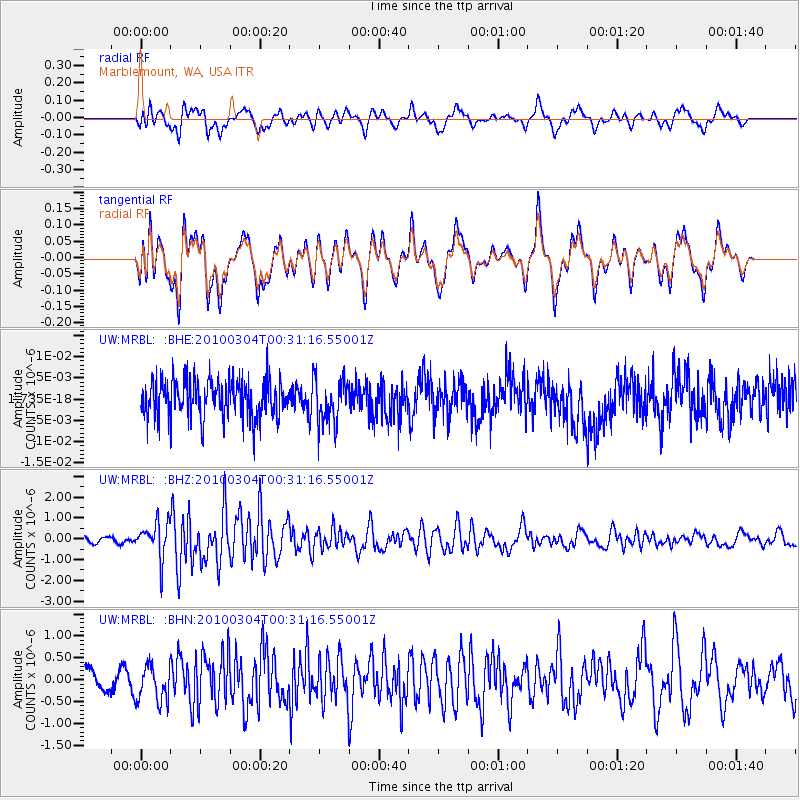
MRBL Marblemount, WA, USA - Earthquake Result Viewer
*The percent match for this event was below the threshold and hence no stack was calculated.
| Earthquake location: |
Taiwan |
| Earthquake latitude/longitude: |
22.9/120.8 |
| Earthquake time(UTC): |
2010/03/04 (063) 00:18:51 GMT |
| Earthquake Depth: |
21 km |
| Earthquake Magnitude: |
6.2 MB, 6.2 MS, 6.3 MW, 6.2 MW |
| Earthquake Catalog/Contributor: |
WHDF/NEIC |
|
| Network: |
UW Pacific Northwest Regional Seismic Network |
| Station: |
MRBL Marblemount, WA, USA |
| Lat/Lon: |
48.52 N/121.48 W |
| Elevation: |
75 m |
|
| Distance: |
89.8 deg |
| Az: |
36.056 deg |
| Baz: |
305.295 deg |
| Ray Param: |
$rayparam |
*The percent match for this event was below the threshold and hence was not used in the summary stack. |
|
| Radial Match: |
62.70544 % |
| Radial Bump: |
400 |
| Transverse Match: |
62.56704 % |
| Transverse Bump: |
400 |
| SOD ConfigId: |
308276 |
| Insert Time: |
2010-06-22 15:48:58.914 +0000 |
| GWidth: |
2.5 |
| Max Bumps: |
400 |
| Tol: |
0.001 |
|
Signal To Noise
| Channel | StoN | STA | LTA |
| UW:MRBL: :BHZ:20100304T00:31:16.55001Z | 2.785506 | 8.6549676E-7 | 3.107144E-7 |
| UW:MRBL: :BHN:20100304T00:31:16.55001Z | 1.2791106 | 4.1747538E-7 | 3.2637942E-7 |
| UW:MRBL: :BHE:20100304T00:31:16.55001Z | 1.2320151 | 5.429902E-9 | 4.4073336E-9 |
| Arrivals |
| Ps | |
| PpPs | |
| PsPs/PpSs | |


