You are here: Home > Network List > TA - USArray Transportable Network (new EarthScope stations) Stations List
> Station C23A Lambert, MT, USA > Earthquake Result Viewer
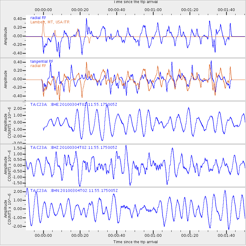
C23A Lambert, MT, USA - Earthquake Result Viewer
*The percent match for this event was below the threshold and hence no stack was calculated.
| Earthquake location: |
Off Coast Of Central Chile |
| Earthquake latitude/longitude: |
-33.2/-72.1 |
| Earthquake time(UTC): |
2010/03/04 (063) 01:59:48 GMT |
| Earthquake Depth: |
24 km |
| Earthquake Magnitude: |
5.6 MB, 5.9 MS, 6.0 MW, 6.0 MW |
| Earthquake Catalog/Contributor: |
WHDF/NEIC |
|
| Network: |
TA USArray Transportable Network (new EarthScope stations) |
| Station: |
C23A Lambert, MT, USA |
| Lat/Lon: |
47.80 N/105.18 W |
| Elevation: |
729 m |
|
| Distance: |
85.9 deg |
| Az: |
338.365 deg |
| Baz: |
152.713 deg |
| Ray Param: |
$rayparam |
*The percent match for this event was below the threshold and hence was not used in the summary stack. |
|
| Radial Match: |
42.24049 % |
| Radial Bump: |
400 |
| Transverse Match: |
38.168964 % |
| Transverse Bump: |
376 |
| SOD ConfigId: |
308276 |
| Insert Time: |
2010-06-22 15:54:23.704 +0000 |
| GWidth: |
2.5 |
| Max Bumps: |
400 |
| Tol: |
0.001 |
|
Signal To Noise
| Channel | StoN | STA | LTA |
| TA:C23A: :BHZ:20100304T02:11:55.175005Z | 1.5116285 | 5.4730253E-7 | 3.6206154E-7 |
| TA:C23A: :BHN:20100304T02:11:55.175005Z | 0.5343227 | 6.5235116E-7 | 1.2208938E-6 |
| TA:C23A: :BHE:20100304T02:11:55.175005Z | 1.6614076 | 1.7832318E-6 | 1.0733258E-6 |
| Arrivals |
| Ps | |
| PpPs | |
| PsPs/PpSs | |


