You are here: Home > Network List > AV - Alaska Volcano Observatory Stations List
> Station MAPS Pakushin Southeast, Makushin Volcano, Alaska > Earthquake Result Viewer
MAPS Pakushin Southeast, Makushin Volcano, Alaska - Earthquake Result Viewer
*The percent match for this event was below the threshold and hence no stack was calculated.
| Earthquake location: |
Java, Indonesia |
| Earthquake latitude/longitude: |
-6.0/112.0 |
| Earthquake time(UTC): |
2023/04/14 (104) 09:55:45 GMT |
| Earthquake Depth: |
594 km |
| Earthquake Magnitude: |
7.0 mww |
| Earthquake Catalog/Contributor: |
NEIC PDE/us |
|
| Network: |
AV Alaska Volcano Observatory |
| Station: |
MAPS Pakushin Southeast, Makushin Volcano, Alaska |
| Lat/Lon: |
53.81 N/166.94 W |
| Elevation: |
333 m |
|
| Distance: |
89.5 deg |
| Az: |
35.862 deg |
| Baz: |
259.237 deg |
| Ray Param: |
$rayparam |
*The percent match for this event was below the threshold and hence was not used in the summary stack. |
|
| Radial Match: |
60.813442 % |
| Radial Bump: |
400 |
| Transverse Match: |
63.67154 % |
| Transverse Bump: |
400 |
| SOD ConfigId: |
30536071 |
| Insert Time: |
2023-04-28 13:06:34.745 +0000 |
| GWidth: |
2.5 |
| Max Bumps: |
400 |
| Tol: |
0.001 |
|
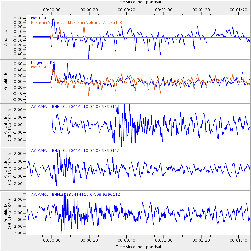
Signal To Noise
| Channel | StoN | STA | LTA |
| AV:MAPS: :BHZ:20230414T10:07:08.939011Z | 2.0235994 | 1.1394601E-6 | 5.6308585E-7 |
| AV:MAPS: :BHN:20230414T10:07:08.939011Z | 1.1835992 | 7.997188E-7 | 6.756669E-7 |
| AV:MAPS: :BHE:20230414T10:07:08.939011Z | 1.9534856 | 1.1524431E-6 | 5.89942E-7 |
| Arrivals |
| Ps | |
| PpPs | |
| PsPs/PpSs | |


