You are here: Home > Network List > GS - US Geological Survey Networks Stations List
> Station KAN05 Bluff City North Station > Earthquake Result Viewer
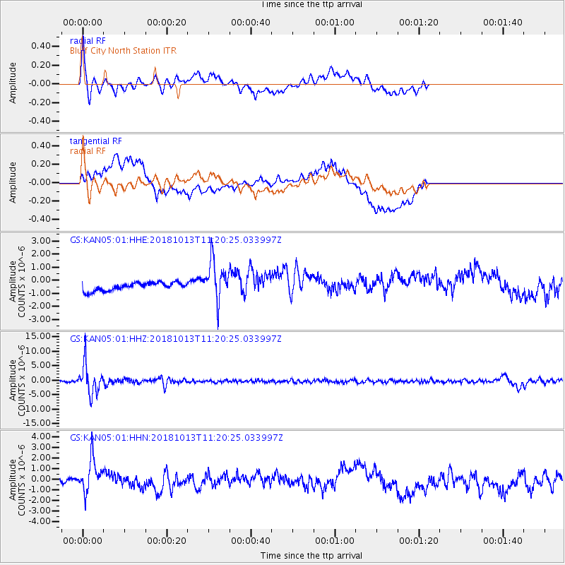
KAN05 Bluff City North Station - Earthquake Result Viewer
*The percent match for this event was below the threshold and hence no stack was calculated.
| Earthquake location: |
Northwest Of Kuril Islands |
| Earthquake latitude/longitude: |
52.7/153.7 |
| Earthquake time(UTC): |
2018/10/13 (286) 11:10:19 GMT |
| Earthquake Depth: |
397 km |
| Earthquake Magnitude: |
6.7 Mi |
| Earthquake Catalog/Contributor: |
NEIC PDE/pt |
|
| Network: |
GS US Geological Survey Networks |
| Station: |
KAN05 Bluff City North Station |
| Lat/Lon: |
37.11 N/97.87 W |
| Elevation: |
348 m |
|
| Distance: |
71.2 deg |
| Az: |
53.244 deg |
| Baz: |
322.416 deg |
| Ray Param: |
$rayparam |
*The percent match for this event was below the threshold and hence was not used in the summary stack. |
|
| Radial Match: |
75.88359 % |
| Radial Bump: |
400 |
| Transverse Match: |
46.734905 % |
| Transverse Bump: |
400 |
| SOD ConfigId: |
3045211 |
| Insert Time: |
2018-10-27 11:20:26.242 +0000 |
| GWidth: |
2.5 |
| Max Bumps: |
400 |
| Tol: |
0.001 |
|
Signal To Noise
| Channel | StoN | STA | LTA |
| GS:KAN05:01:HHZ:20181013T11:20:25.033997Z | 28.3509 | 5.0893673E-6 | 1.7951344E-7 |
| GS:KAN05:01:HHN:20181013T11:20:25.033997Z | 4.8832803 | 1.6464465E-6 | 3.3715995E-7 |
| GS:KAN05:01:HHE:20181013T11:20:25.033997Z | 5.146216 | 1.5697883E-6 | 3.050374E-7 |
| Arrivals |
| Ps | |
| PpPs | |
| PsPs/PpSs | |


