You are here: Home > Network List > GS - US Geological Survey Networks Stations List
> Station KAN08 Anthony NE Station > Earthquake Result Viewer
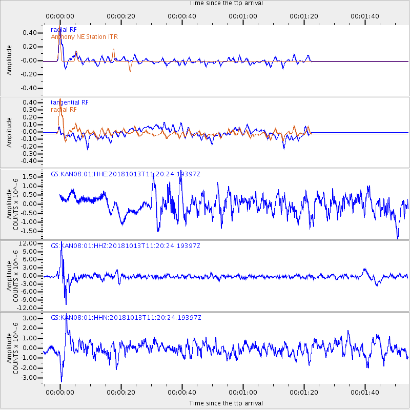
KAN08 Anthony NE Station - Earthquake Result Viewer
*The percent match for this event was below the threshold and hence no stack was calculated.
| Earthquake location: |
Northwest Of Kuril Islands |
| Earthquake latitude/longitude: |
52.7/153.7 |
| Earthquake time(UTC): |
2018/10/13 (286) 11:10:19 GMT |
| Earthquake Depth: |
397 km |
| Earthquake Magnitude: |
6.7 Mi |
| Earthquake Catalog/Contributor: |
NEIC PDE/pt |
|
| Network: |
GS US Geological Survey Networks |
| Station: |
KAN08 Anthony NE Station |
| Lat/Lon: |
37.23 N/97.97 W |
| Elevation: |
375 m |
|
| Distance: |
71.0 deg |
| Az: |
53.234 deg |
| Baz: |
322.353 deg |
| Ray Param: |
$rayparam |
*The percent match for this event was below the threshold and hence was not used in the summary stack. |
|
| Radial Match: |
77.56632 % |
| Radial Bump: |
399 |
| Transverse Match: |
53.405647 % |
| Transverse Bump: |
400 |
| SOD ConfigId: |
3045211 |
| Insert Time: |
2018-10-27 11:20:29.506 +0000 |
| GWidth: |
2.5 |
| Max Bumps: |
400 |
| Tol: |
0.001 |
|
Signal To Noise
| Channel | StoN | STA | LTA |
| GS:KAN08:01:HHZ:20181013T11:20:24.19397Z | 24.429327 | 4.5860847E-6 | 1.8772867E-7 |
| GS:KAN08:01:HHN:20181013T11:20:24.19397Z | 4.1147966 | 1.5112215E-6 | 3.672652E-7 |
| GS:KAN08:01:HHE:20181013T11:20:24.19397Z | 1.8504084 | 8.2948753E-7 | 4.482727E-7 |
| Arrivals |
| Ps | |
| PpPs | |
| PsPs/PpSs | |


