You are here: Home > Network List > GM - US Geological Survey Networks Stations List
> Station IWM01 Jericho 2M Well Monitoring Station > Earthquake Result Viewer
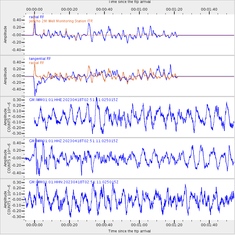
IWM01 Jericho 2M Well Monitoring Station - Earthquake Result Viewer
*The percent match for this event was below the threshold and hence no stack was calculated.
| Earthquake location: |
Near East Coast Of Kamchatka |
| Earthquake latitude/longitude: |
54.2/159.8 |
| Earthquake time(UTC): |
2023/04/18 (108) 02:40:53 GMT |
| Earthquake Depth: |
112 km |
| Earthquake Magnitude: |
5.6 Mww |
| Earthquake Catalog/Contributor: |
NEIC PDE/us |
|
| Network: |
GM US Geological Survey Networks |
| Station: |
IWM01 Jericho 2M Well Monitoring Station |
| Lat/Lon: |
36.73 N/96.53 W |
| Elevation: |
328 m |
|
| Distance: |
68.3 deg |
| Az: |
57.202 deg |
| Baz: |
322.037 deg |
| Ray Param: |
$rayparam |
*The percent match for this event was below the threshold and hence was not used in the summary stack. |
|
| Radial Match: |
46.17776 % |
| Radial Bump: |
400 |
| Transverse Match: |
79.063194 % |
| Transverse Bump: |
400 |
| SOD ConfigId: |
30536071 |
| Insert Time: |
2023-05-02 02:52:42.702 +0000 |
| GWidth: |
2.5 |
| Max Bumps: |
400 |
| Tol: |
0.001 |
|
Signal To Noise
| Channel | StoN | STA | LTA |
| GM:IWM01:01:HHZ:20230418T02:51:11.025015Z | 3.4944656 | 2.641765E-7 | 7.5598535E-8 |
| GM:IWM01:01:HHN:20230418T02:51:11.025015Z | 1.1419227 | 1.2284458E-7 | 1.07576966E-7 |
| GM:IWM01:01:HHE:20230418T02:51:11.025015Z | 1.5167902 | 1.4572595E-7 | 9.6075226E-8 |
| Arrivals |
| Ps | |
| PpPs | |
| PsPs/PpSs | |


