You are here: Home > Network List > NE - New England Seismic Network Stations List
> Station EMMW Machias, ME, USA > Earthquake Result Viewer
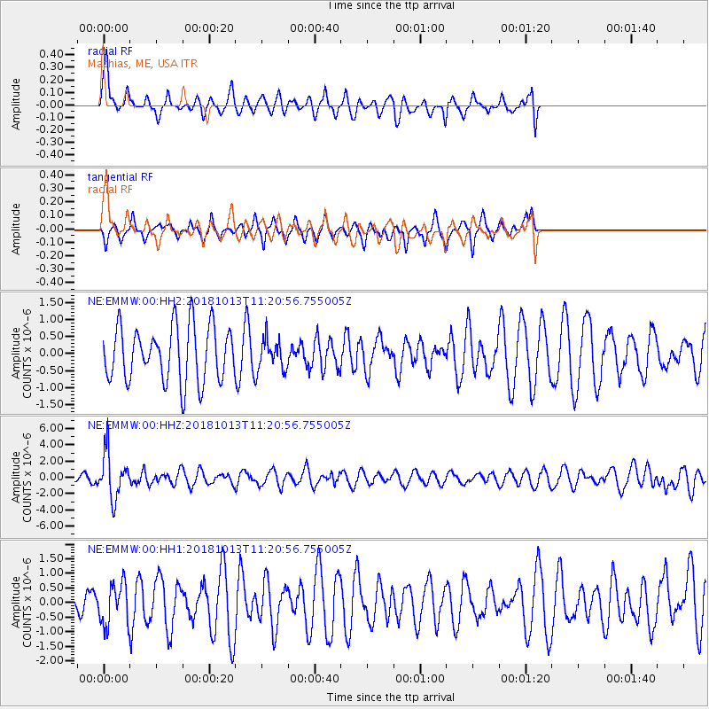
EMMW Machias, ME, USA - Earthquake Result Viewer
*The percent match for this event was below the threshold and hence no stack was calculated.
| Earthquake location: |
Northwest Of Kuril Islands |
| Earthquake latitude/longitude: |
52.7/153.7 |
| Earthquake time(UTC): |
2018/10/13 (286) 11:10:19 GMT |
| Earthquake Depth: |
397 km |
| Earthquake Magnitude: |
6.7 Mi |
| Earthquake Catalog/Contributor: |
NEIC PDE/pt |
|
| Network: |
NE New England Seismic Network |
| Station: |
EMMW Machias, ME, USA |
| Lat/Lon: |
44.71 N/67.46 W |
| Elevation: |
35 m |
|
| Distance: |
76.7 deg |
| Az: |
28.81 deg |
| Baz: |
335.714 deg |
| Ray Param: |
$rayparam |
*The percent match for this event was below the threshold and hence was not used in the summary stack. |
|
| Radial Match: |
70.92368 % |
| Radial Bump: |
400 |
| Transverse Match: |
68.16879 % |
| Transverse Bump: |
366 |
| SOD ConfigId: |
3045211 |
| Insert Time: |
2018-10-27 11:22:36.270 +0000 |
| GWidth: |
2.5 |
| Max Bumps: |
400 |
| Tol: |
0.001 |
|
Signal To Noise
| Channel | StoN | STA | LTA |
| NE:EMMW:00:HHZ:20181013T11:20:56.755005Z | 3.3175385 | 2.792299E-6 | 8.4167795E-7 |
| NE:EMMW:00:HH1:20181013T11:20:56.755005Z | 1.195107 | 7.177441E-7 | 6.0056897E-7 |
| NE:EMMW:00:HH2:20181013T11:20:56.755005Z | 0.5436738 | 4.4051384E-7 | 8.1025394E-7 |
| Arrivals |
| Ps | |
| PpPs | |
| PsPs/PpSs | |


