You are here: Home > Network List > NE - New England Seismic Network Stations List
> Station PQI Presque Isle, ME, USA > Earthquake Result Viewer
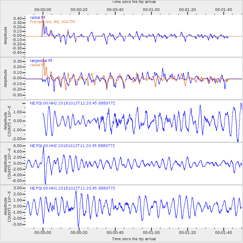
PQI Presque Isle, ME, USA - Earthquake Result Viewer
*The percent match for this event was below the threshold and hence no stack was calculated.
| Earthquake location: |
Northwest Of Kuril Islands |
| Earthquake latitude/longitude: |
52.7/153.7 |
| Earthquake time(UTC): |
2018/10/13 (286) 11:10:19 GMT |
| Earthquake Depth: |
397 km |
| Earthquake Magnitude: |
6.7 Mi |
| Earthquake Catalog/Contributor: |
NEIC PDE/pt |
|
| Network: |
NE New England Seismic Network |
| Station: |
PQI Presque Isle, ME, USA |
| Lat/Lon: |
46.67 N/68.02 W |
| Elevation: |
162 m |
|
| Distance: |
74.8 deg |
| Az: |
28.337 deg |
| Baz: |
335.197 deg |
| Ray Param: |
$rayparam |
*The percent match for this event was below the threshold and hence was not used in the summary stack. |
|
| Radial Match: |
53.57755 % |
| Radial Bump: |
400 |
| Transverse Match: |
71.949585 % |
| Transverse Bump: |
371 |
| SOD ConfigId: |
3045211 |
| Insert Time: |
2018-10-27 11:22:39.966 +0000 |
| GWidth: |
2.5 |
| Max Bumps: |
400 |
| Tol: |
0.001 |
|
Signal To Noise
| Channel | StoN | STA | LTA |
| NE:PQI:00:HHZ:20181013T11:20:45.888977Z | 4.1736407 | 3.2157743E-6 | 7.7049623E-7 |
| NE:PQI:00:HH1:20181013T11:20:45.888977Z | 1.6754158 | 1.150317E-6 | 6.8658596E-7 |
| NE:PQI:00:HH2:20181013T11:20:45.888977Z | 0.74459356 | 4.8964245E-7 | 6.5759696E-7 |
| Arrivals |
| Ps | |
| PpPs | |
| PsPs/PpSs | |


