You are here: Home > Network List > TA - USArray Transportable Network (new EarthScope stations) Stations List
> Station POKR Poker Plat Research Range, AK, USA > Earthquake Result Viewer
POKR Poker Plat Research Range, AK, USA - Earthquake Result Viewer

| Earthquake location: |
Northwest Of Kuril Islands |
| Earthquake latitude/longitude: |
52.7/153.7 |
| Earthquake time(UTC): |
2018/10/13 (286) 11:10:19 GMT |
| Earthquake Depth: |
397 km |
| Earthquake Magnitude: |
6.7 Mi |
| Earthquake Catalog/Contributor: |
NEIC PDE/pt |
|
| Network: |
TA USArray Transportable Network (new EarthScope stations) |
| Station: |
POKR Poker Plat Research Range, AK, USA |
| Lat/Lon: |
65.12 N/147.43 W |
| Elevation: |
501 m |
|
| Distance: |
31.6 deg |
| Az: |
43.782 deg |
| Baz: |
275.571 deg |
| Ray Param: |
0.07755801 |
| Estimated Moho Depth: |
27.0 km |
| Estimated Crust Vp/Vs: |
1.91 |
| Assumed Crust Vp: |
6.566 km/s |
| Estimated Crust Vs: |
3.438 km/s |
| Estimated Crust Poisson's Ratio: |
0.31 |
|
| Radial Match: |
90.9841 % |
| Radial Bump: |
400 |
| Transverse Match: |
73.9895 % |
| Transverse Bump: |
400 |
| SOD ConfigId: |
3045211 |
| Insert Time: |
2018-10-27 11:23:46.457 +0000 |
| GWidth: |
2.5 |
| Max Bumps: |
400 |
| Tol: |
0.001 |
|
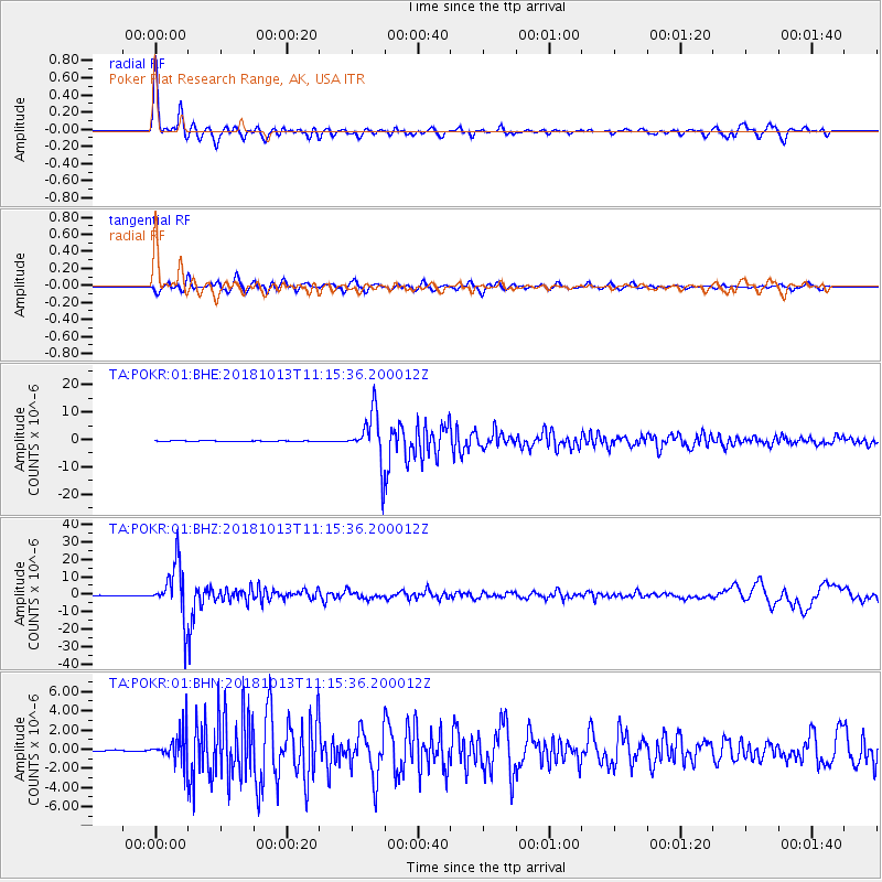
Signal To Noise
| Channel | StoN | STA | LTA |
| TA:POKR:01:BHZ:20181013T11:15:36.200012Z | 203.80458 | 1.5478181E-5 | 7.594619E-8 |
| TA:POKR:01:BHN:20181013T11:15:36.200012Z | 12.365943 | 1.5571294E-6 | 1.259208E-7 |
| TA:POKR:01:BHE:20181013T11:15:36.200012Z | 87.538185 | 9.221283E-6 | 1.0534011E-7 |
| Arrivals |
| Ps | 4.0 SECOND |
| PpPs | 11 SECOND |
| PsPs/PpSs | 15 SECOND |


