You are here: Home > Network List > IU - Global Seismograph Network (GSN - IRIS/USGS) Stations List
> Station PMG Port Moresby, New Guinea > Earthquake Result Viewer
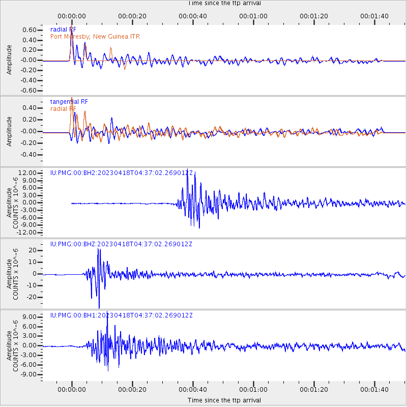
PMG Port Moresby, New Guinea - Earthquake Result Viewer
*The percent match for this event was below the threshold and hence no stack was calculated.
| Earthquake location: |
South Of Fiji Islands |
| Earthquake latitude/longitude: |
-22.3/179.5 |
| Earthquake time(UTC): |
2023/04/18 (108) 04:31:41 GMT |
| Earthquake Depth: |
602 km |
| Earthquake Magnitude: |
6.5 Mi |
| Earthquake Catalog/Contributor: |
NEIC PDE/at |
|
| Network: |
IU Global Seismograph Network (GSN - IRIS/USGS) |
| Station: |
PMG Port Moresby, New Guinea |
| Lat/Lon: |
9.40 S/147.16 E |
| Elevation: |
90 m |
|
| Distance: |
33.6 deg |
| Az: |
287.278 deg |
| Baz: |
116.337 deg |
| Ray Param: |
$rayparam |
*The percent match for this event was below the threshold and hence was not used in the summary stack. |
|
| Radial Match: |
92.641014 % |
| Radial Bump: |
400 |
| Transverse Match: |
89.47431 % |
| Transverse Bump: |
400 |
| SOD ConfigId: |
30536071 |
| Insert Time: |
2023-05-02 04:42:28.175 +0000 |
| GWidth: |
2.5 |
| Max Bumps: |
400 |
| Tol: |
0.001 |
|
Signal To Noise
| Channel | StoN | STA | LTA |
| IU:PMG:00:BHZ:20230418T04:37:02.269012Z | 4.1215186 | 6.178944E-7 | 1.4991909E-7 |
| IU:PMG:00:BH1:20230418T04:37:02.269012Z | 1.5269855 | 1.6838034E-7 | 1.10269774E-7 |
| IU:PMG:00:BH2:20230418T04:37:02.269012Z | 3.1239386 | 2.580634E-7 | 8.2608345E-8 |
| Arrivals |
| Ps | |
| PpPs | |
| PsPs/PpSs | |


