You are here: Home > Network List > IW - Intermountain West Stations List
> Station PLID Pearl Lake, Idaho, USA > Earthquake Result Viewer
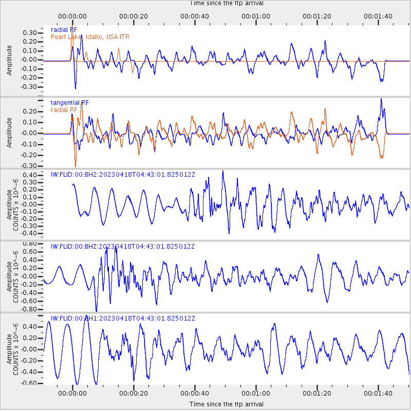
PLID Pearl Lake, Idaho, USA - Earthquake Result Viewer
*The percent match for this event was below the threshold and hence no stack was calculated.
| Earthquake location: |
South Of Fiji Islands |
| Earthquake latitude/longitude: |
-22.3/179.5 |
| Earthquake time(UTC): |
2023/04/18 (108) 04:31:41 GMT |
| Earthquake Depth: |
602 km |
| Earthquake Magnitude: |
6.5 Mi |
| Earthquake Catalog/Contributor: |
NEIC PDE/at |
|
| Network: |
IW Intermountain West |
| Station: |
PLID Pearl Lake, Idaho, USA |
| Lat/Lon: |
45.09 N/116.00 W |
| Elevation: |
2164 m |
|
| Distance: |
89.1 deg |
| Az: |
39.753 deg |
| Baz: |
236.719 deg |
| Ray Param: |
$rayparam |
*The percent match for this event was below the threshold and hence was not used in the summary stack. |
|
| Radial Match: |
41.768772 % |
| Radial Bump: |
390 |
| Transverse Match: |
30.926884 % |
| Transverse Bump: |
353 |
| SOD ConfigId: |
30536071 |
| Insert Time: |
2023-05-02 04:42:39.565 +0000 |
| GWidth: |
2.5 |
| Max Bumps: |
400 |
| Tol: |
0.001 |
|
Signal To Noise
| Channel | StoN | STA | LTA |
| IW:PLID:00:BHZ:20230418T04:43:01.825012Z | 1.3023561 | 1.831628E-7 | 1.4063957E-7 |
| IW:PLID:00:BH1:20230418T04:43:01.825012Z | 2.2872531 | 4.2532423E-7 | 1.8595416E-7 |
| IW:PLID:00:BH2:20230418T04:43:01.825012Z | 0.3374849 | 4.8393613E-8 | 1.4339491E-7 |
| Arrivals |
| Ps | |
| PpPs | |
| PsPs/PpSs | |


