You are here: Home > Network List > TA - USArray Transportable Network (new EarthScope stations) Stations List
> Station G05D Wamic, OR, USA > Earthquake Result Viewer
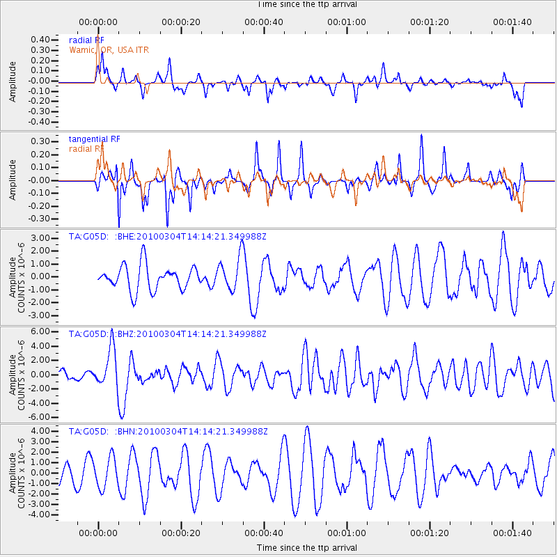
G05D Wamic, OR, USA - Earthquake Result Viewer
*The percent match for this event was below the threshold and hence no stack was calculated.
| Earthquake location: |
Vanuatu Islands |
| Earthquake latitude/longitude: |
-13.6/167.2 |
| Earthquake time(UTC): |
2010/03/04 (063) 14:02:27 GMT |
| Earthquake Depth: |
176 km |
| Earthquake Magnitude: |
6.0 MB, 6.5 MW, 6.4 MW |
| Earthquake Catalog/Contributor: |
WHDF/NEIC |
|
| Network: |
TA USArray Transportable Network (new EarthScope stations) |
| Station: |
G05D Wamic, OR, USA |
| Lat/Lon: |
45.24 N/121.32 W |
| Elevation: |
592 m |
|
| Distance: |
86.9 deg |
| Az: |
42.127 deg |
| Baz: |
247.409 deg |
| Ray Param: |
$rayparam |
*The percent match for this event was below the threshold and hence was not used in the summary stack. |
|
| Radial Match: |
63.21177 % |
| Radial Bump: |
329 |
| Transverse Match: |
62.017696 % |
| Transverse Bump: |
288 |
| SOD ConfigId: |
308276 |
| Insert Time: |
2010-06-22 16:22:46.222 +0000 |
| GWidth: |
2.5 |
| Max Bumps: |
400 |
| Tol: |
0.001 |
|
Signal To Noise
| Channel | StoN | STA | LTA |
| TA:G05D: :BHZ:20100304T14:14:21.349988Z | 5.0240326 | 2.8728398E-6 | 5.718195E-7 |
| TA:G05D: :BHN:20100304T14:14:21.349988Z | 0.9208993 | 1.4520476E-6 | 1.5767714E-6 |
| TA:G05D: :BHE:20100304T14:14:21.349988Z | 1.4126548 | 1.3294043E-6 | 9.410681E-7 |
| Arrivals |
| Ps | |
| PpPs | |
| PsPs/PpSs | |


