You are here: Home > Network List > CN - Canadian National Seismograph Network Stations List
> Station INK INUVIK, NT > Earthquake Result Viewer
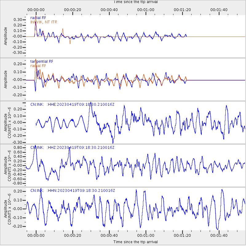
INK INUVIK, NT - Earthquake Result Viewer
*The percent match for this event was below the threshold and hence no stack was calculated.
| Earthquake location: |
New Britain Region, P.N.G. |
| Earthquake latitude/longitude: |
-5.9/149.6 |
| Earthquake time(UTC): |
2023/04/19 (109) 09:06:03 GMT |
| Earthquake Depth: |
40 km |
| Earthquake Magnitude: |
6.3 mww |
| Earthquake Catalog/Contributor: |
NEIC PDE/us |
|
| Network: |
CN Canadian National Seismograph Network |
| Station: |
INK INUVIK, NT |
| Lat/Lon: |
68.31 N/133.53 W |
| Elevation: |
44 m |
|
| Distance: |
90.6 deg |
| Az: |
21.226 deg |
| Baz: |
255.613 deg |
| Ray Param: |
$rayparam |
*The percent match for this event was below the threshold and hence was not used in the summary stack. |
|
| Radial Match: |
69.15054 % |
| Radial Bump: |
342 |
| Transverse Match: |
60.6783 % |
| Transverse Bump: |
400 |
| SOD ConfigId: |
30536071 |
| Insert Time: |
2023-05-03 09:18:27.001 +0000 |
| GWidth: |
2.5 |
| Max Bumps: |
400 |
| Tol: |
0.001 |
|
Signal To Noise
| Channel | StoN | STA | LTA |
| CN:INK: :HHZ:20230419T09:18:30.210016Z | 5.047802 | 4.397908E-7 | 8.712521E-8 |
| CN:INK: :HHN:20230419T09:18:30.210016Z | 1.352105 | 1.04994335E-7 | 7.76525E-8 |
| CN:INK: :HHE:20230419T09:18:30.210016Z | 2.9446437 | 1.5930956E-7 | 5.4101474E-8 |
| Arrivals |
| Ps | |
| PpPs | |
| PsPs/PpSs | |


