You are here: Home > Network List > US - United States National Seismic Network Stations List
> Station MNTX Cornudas Mountains, Texas, USA > Earthquake Result Viewer
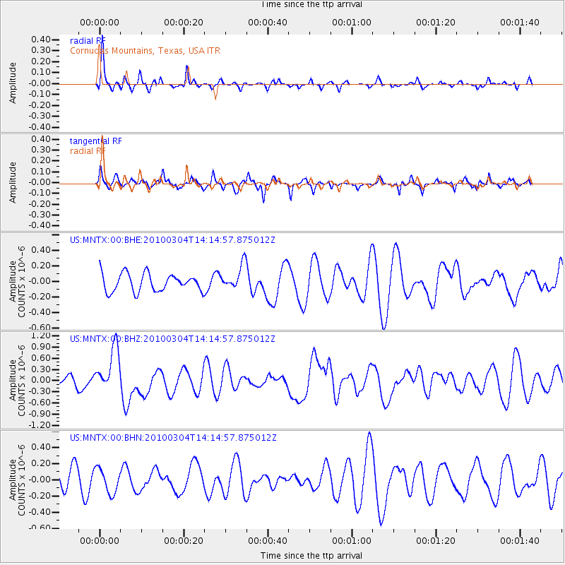
MNTX Cornudas Mountains, Texas, USA - Earthquake Result Viewer
*The percent match for this event was below the threshold and hence no stack was calculated.
| Earthquake location: |
Vanuatu Islands |
| Earthquake latitude/longitude: |
-13.6/167.2 |
| Earthquake time(UTC): |
2010/03/04 (063) 14:02:27 GMT |
| Earthquake Depth: |
176 km |
| Earthquake Magnitude: |
6.0 MB, 6.5 MW, 6.4 MW |
| Earthquake Catalog/Contributor: |
WHDF/NEIC |
|
| Network: |
US United States National Seismic Network |
| Station: |
MNTX Cornudas Mountains, Texas, USA |
| Lat/Lon: |
31.70 N/105.38 W |
| Elevation: |
404 m |
|
| Distance: |
94.8 deg |
| Az: |
58.71 deg |
| Baz: |
257.133 deg |
| Ray Param: |
$rayparam |
*The percent match for this event was below the threshold and hence was not used in the summary stack. |
|
| Radial Match: |
55.081596 % |
| Radial Bump: |
276 |
| Transverse Match: |
52.481018 % |
| Transverse Bump: |
312 |
| SOD ConfigId: |
308276 |
| Insert Time: |
2010-06-22 16:24:50.017 +0000 |
| GWidth: |
2.5 |
| Max Bumps: |
400 |
| Tol: |
0.001 |
|
Signal To Noise
| Channel | StoN | STA | LTA |
| US:MNTX:00:BHZ:20100304T14:14:57.875012Z | 5.237291 | 6.224075E-7 | 1.18841506E-7 |
| US:MNTX:00:BHN:20100304T14:14:57.875012Z | 1.1996471 | 1.5092294E-7 | 1.2580612E-7 |
| US:MNTX:00:BHE:20100304T14:14:57.875012Z | 1.4594527 | 1.6527308E-7 | 1.1324319E-7 |
| Arrivals |
| Ps | |
| PpPs | |
| PsPs/PpSs | |


