You are here: Home > Network List > G - GEOSCOPE Stations List
> Station PPTF Pamatai - Papeete - Tahiti island - French Polynesia, France > Earthquake Result Viewer
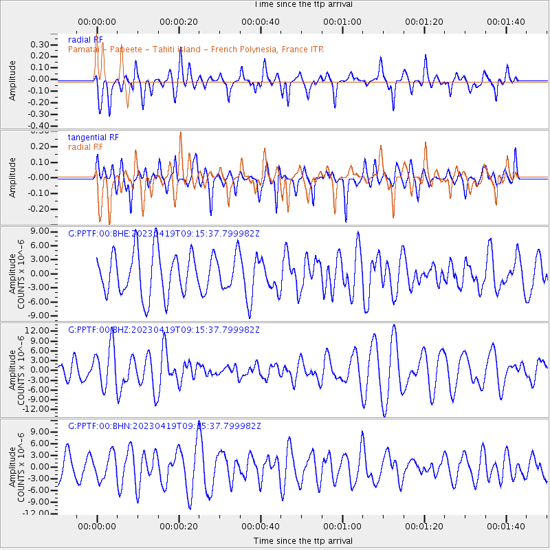
PPTF Pamatai - Papeete - Tahiti island - French Polynesia, France - Earthquake Result Viewer
*The percent match for this event was below the threshold and hence no stack was calculated.
| Earthquake location: |
New Britain Region, P.N.G. |
| Earthquake latitude/longitude: |
-5.9/149.6 |
| Earthquake time(UTC): |
2023/04/19 (109) 09:06:03 GMT |
| Earthquake Depth: |
40 km |
| Earthquake Magnitude: |
6.3 mww |
| Earthquake Catalog/Contributor: |
NEIC PDE/us |
|
| Network: |
G GEOSCOPE |
| Station: |
PPTF Pamatai - Papeete - Tahiti island - French Polynesia, France |
| Lat/Lon: |
17.59 S/149.57 W |
| Elevation: |
705 m |
|
| Distance: |
60.4 deg |
| Az: |
106.768 deg |
| Baz: |
273.137 deg |
| Ray Param: |
$rayparam |
*The percent match for this event was below the threshold and hence was not used in the summary stack. |
|
| Radial Match: |
51.919212 % |
| Radial Bump: |
400 |
| Transverse Match: |
49.90186 % |
| Transverse Bump: |
400 |
| SOD ConfigId: |
30536071 |
| Insert Time: |
2023-05-03 09:19:25.579 +0000 |
| GWidth: |
2.5 |
| Max Bumps: |
400 |
| Tol: |
0.001 |
|
Signal To Noise
| Channel | StoN | STA | LTA |
| G:PPTF:00:BHZ:20230419T09:15:37.799982Z | 2.0757594 | 6.560816E-6 | 3.1606821E-6 |
| G:PPTF:00:BHN:20230419T09:15:37.799982Z | 1.1639075 | 3.1972068E-6 | 2.7469594E-6 |
| G:PPTF:00:BHE:20230419T09:15:37.799982Z | 0.75871074 | 3.5565135E-6 | 4.687575E-6 |
| Arrivals |
| Ps | |
| PpPs | |
| PsPs/PpSs | |


