You are here: Home > Network List > UW - Pacific Northwest Regional Seismic Network Stations List
> Station MRBL Marblemount, WA, USA > Earthquake Result Viewer
MRBL Marblemount, WA, USA - Earthquake Result Viewer
*The percent match for this event was below the threshold and hence no stack was calculated.
| Earthquake location: |
Vanuatu Islands |
| Earthquake latitude/longitude: |
-13.6/167.2 |
| Earthquake time(UTC): |
2010/03/04 (063) 14:02:27 GMT |
| Earthquake Depth: |
176 km |
| Earthquake Magnitude: |
6.0 MB, 6.5 MW, 6.4 MW |
| Earthquake Catalog/Contributor: |
WHDF/NEIC |
|
| Network: |
UW Pacific Northwest Regional Seismic Network |
| Station: |
MRBL Marblemount, WA, USA |
| Lat/Lon: |
48.52 N/121.48 W |
| Elevation: |
75 m |
|
| Distance: |
88.1 deg |
| Az: |
39.056 deg |
| Baz: |
247.154 deg |
| Ray Param: |
$rayparam |
*The percent match for this event was below the threshold and hence was not used in the summary stack. |
|
| Radial Match: |
65.138435 % |
| Radial Bump: |
400 |
| Transverse Match: |
65.35377 % |
| Transverse Bump: |
400 |
| SOD ConfigId: |
308276 |
| Insert Time: |
2010-06-22 16:25:58.343 +0000 |
| GWidth: |
2.5 |
| Max Bumps: |
400 |
| Tol: |
0.001 |
|
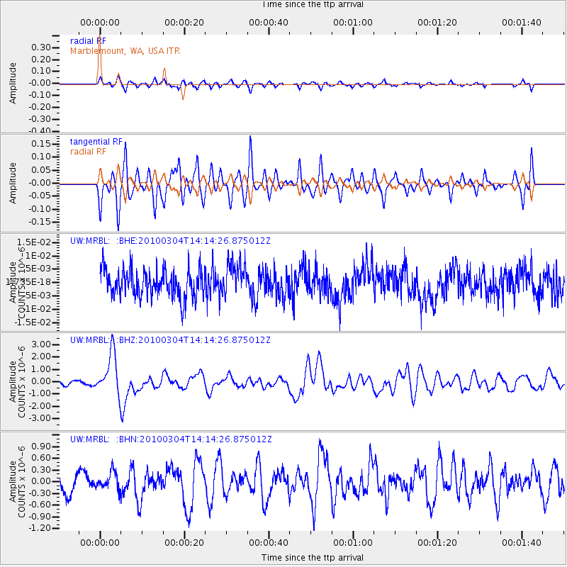
Signal To Noise
| Channel | StoN | STA | LTA |
| UW:MRBL: :BHZ:20100304T14:14:26.875012Z | 5.109666 | 1.7253959E-6 | 3.3767296E-7 |
| UW:MRBL: :BHN:20100304T14:14:26.875012Z | 0.86019963 | 2.2752585E-7 | 2.6450354E-7 |
| UW:MRBL: :BHE:20100304T14:14:26.875012Z | 1.2487612 | 6.314995E-9 | 5.057008E-9 |
| Arrivals |
| Ps | |
| PpPs | |
| PsPs/PpSs | |


