You are here: Home > Network List > UW - Pacific Northwest Regional Seismic Network Stations List
> Station LEBA Lebam, WA, USA > Earthquake Result Viewer
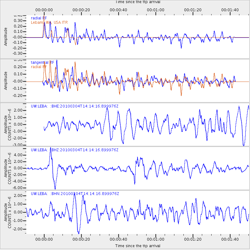
LEBA Lebam, WA, USA - Earthquake Result Viewer
*The percent match for this event was below the threshold and hence no stack was calculated.
| Earthquake location: |
Vanuatu Islands |
| Earthquake latitude/longitude: |
-13.6/167.2 |
| Earthquake time(UTC): |
2010/03/04 (063) 14:02:27 GMT |
| Earthquake Depth: |
176 km |
| Earthquake Magnitude: |
6.0 MB, 6.5 MW, 6.4 MW |
| Earthquake Catalog/Contributor: |
WHDF/NEIC |
|
| Network: |
UW Pacific Northwest Regional Seismic Network |
| Station: |
LEBA Lebam, WA, USA |
| Lat/Lon: |
46.55 N/123.56 W |
| Elevation: |
73 m |
|
| Distance: |
86.0 deg |
| Az: |
40.303 deg |
| Baz: |
245.689 deg |
| Ray Param: |
$rayparam |
*The percent match for this event was below the threshold and hence was not used in the summary stack. |
|
| Radial Match: |
58.26212 % |
| Radial Bump: |
400 |
| Transverse Match: |
65.04284 % |
| Transverse Bump: |
400 |
| SOD ConfigId: |
308276 |
| Insert Time: |
2010-06-22 16:26:32.524 +0000 |
| GWidth: |
2.5 |
| Max Bumps: |
400 |
| Tol: |
0.001 |
|
Signal To Noise
| Channel | StoN | STA | LTA |
| UW:LEBA: :BHZ:20100304T14:14:16.899976Z | 4.2337956 | 2.4233925E-6 | 5.723924E-7 |
| UW:LEBA: :BHN:20100304T14:14:16.899976Z | 1.0407199 | 6.124592E-7 | 5.884957E-7 |
| UW:LEBA: :BHE:20100304T14:14:16.899976Z | 2.8011389 | 1.2219514E-6 | 4.3623373E-7 |
| Arrivals |
| Ps | |
| PpPs | |
| PsPs/PpSs | |


