You are here: Home > Network List > IU - Global Seismograph Network (GSN - IRIS/USGS) Stations List
> Station PMG Port Moresby, New Guinea > Earthquake Result Viewer
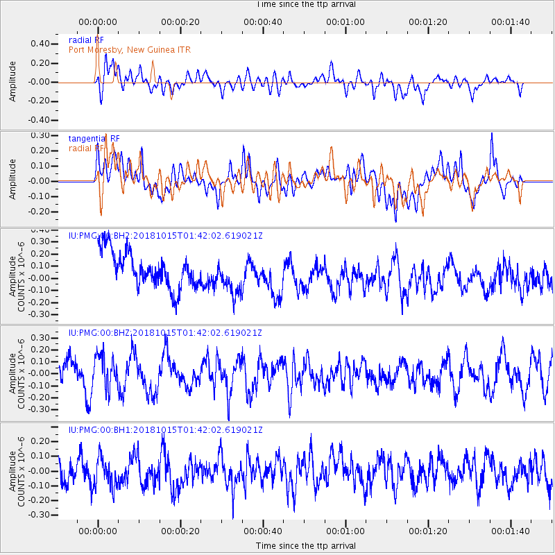
PMG Port Moresby, New Guinea - Earthquake Result Viewer
*The percent match for this event was below the threshold and hence no stack was calculated.
| Earthquake location: |
Near East Coast Of Kamchatka |
| Earthquake latitude/longitude: |
54.1/159.5 |
| Earthquake time(UTC): |
2018/10/15 (288) 01:32:12 GMT |
| Earthquake Depth: |
124 km |
| Earthquake Magnitude: |
5.6 mb |
| Earthquake Catalog/Contributor: |
NEIC PDE/us |
|
| Network: |
IU Global Seismograph Network (GSN - IRIS/USGS) |
| Station: |
PMG Port Moresby, New Guinea |
| Lat/Lon: |
9.40 S/147.16 E |
| Elevation: |
90 m |
|
| Distance: |
64.1 deg |
| Az: |
193.517 deg |
| Baz: |
8.026 deg |
| Ray Param: |
$rayparam |
*The percent match for this event was below the threshold and hence was not used in the summary stack. |
|
| Radial Match: |
54.381977 % |
| Radial Bump: |
400 |
| Transverse Match: |
44.575504 % |
| Transverse Bump: |
400 |
| SOD ConfigId: |
3045211 |
| Insert Time: |
2018-10-29 01:39:06.154 +0000 |
| GWidth: |
2.5 |
| Max Bumps: |
400 |
| Tol: |
0.001 |
|
Signal To Noise
| Channel | StoN | STA | LTA |
| IU:PMG:00:BHZ:20181015T01:42:02.619021Z | 1.2176373 | 1.3558524E-7 | 1.11351085E-7 |
| IU:PMG:00:BH1:20181015T01:42:02.619021Z | 1.0471039 | 1.0205907E-7 | 9.746795E-8 |
| IU:PMG:00:BH2:20181015T01:42:02.619021Z | 1.0749091 | 1.5549682E-7 | 1.4466043E-7 |
| Arrivals |
| Ps | |
| PpPs | |
| PsPs/PpSs | |


