You are here: Home > Network List > IU - Global Seismograph Network (GSN - IRIS/USGS) Stations List
> Station RSSD Black Hills, South Dakota, USA > Earthquake Result Viewer
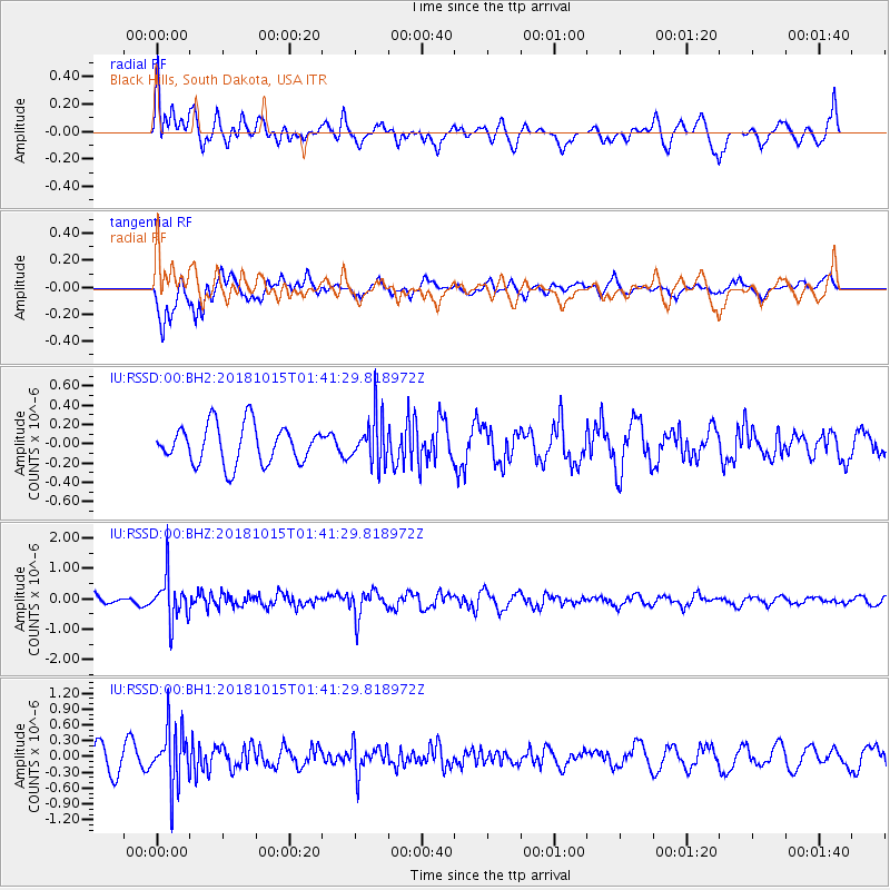
RSSD Black Hills, South Dakota, USA - Earthquake Result Viewer
*The percent match for this event was below the threshold and hence no stack was calculated.
| Earthquake location: |
Near East Coast Of Kamchatka |
| Earthquake latitude/longitude: |
54.1/159.5 |
| Earthquake time(UTC): |
2018/10/15 (288) 01:32:12 GMT |
| Earthquake Depth: |
124 km |
| Earthquake Magnitude: |
5.6 mb |
| Earthquake Catalog/Contributor: |
NEIC PDE/us |
|
| Network: |
IU Global Seismograph Network (GSN - IRIS/USGS) |
| Station: |
RSSD Black Hills, South Dakota, USA |
| Lat/Lon: |
44.12 N/104.04 W |
| Elevation: |
2090 m |
|
| Distance: |
59.2 deg |
| Az: |
56.433 deg |
| Baz: |
317.003 deg |
| Ray Param: |
$rayparam |
*The percent match for this event was below the threshold and hence was not used in the summary stack. |
|
| Radial Match: |
55.085327 % |
| Radial Bump: |
400 |
| Transverse Match: |
60.905857 % |
| Transverse Bump: |
400 |
| SOD ConfigId: |
3045211 |
| Insert Time: |
2018-10-29 01:39:15.030 +0000 |
| GWidth: |
2.5 |
| Max Bumps: |
400 |
| Tol: |
0.001 |
|
Signal To Noise
| Channel | StoN | STA | LTA |
| IU:RSSD:00:BHZ:20181015T01:41:29.818972Z | 3.2358418 | 7.397339E-7 | 2.2860632E-7 |
| IU:RSSD:00:BH1:20181015T01:41:29.818972Z | 2.8697474 | 5.4621734E-7 | 1.9033638E-7 |
| IU:RSSD:00:BH2:20181015T01:41:29.818972Z | 1.2256175 | 2.4386057E-7 | 1.9896954E-7 |
| Arrivals |
| Ps | |
| PpPs | |
| PsPs/PpSs | |


