You are here: Home > Network List > TA - USArray Transportable Network (new EarthScope stations) Stations List
> Station BRSD Miller, SD, USA > Earthquake Result Viewer
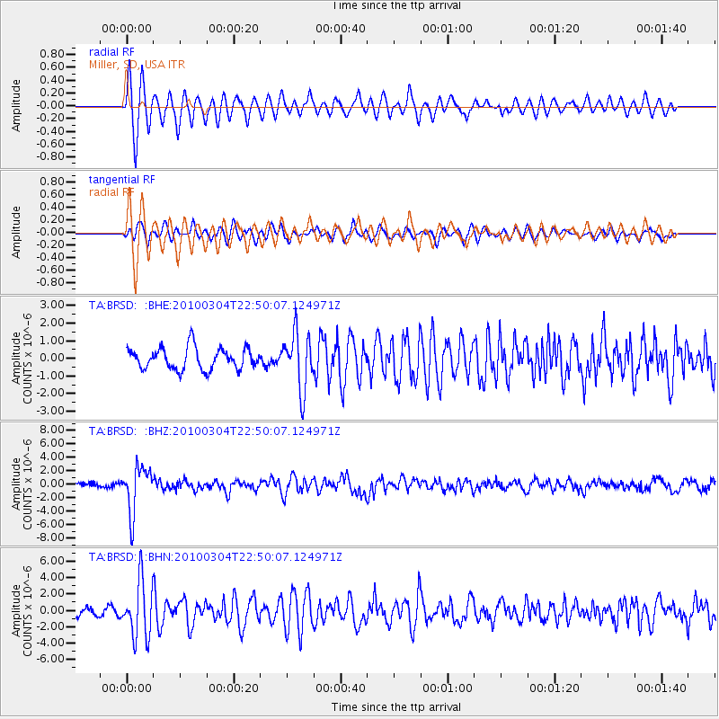
BRSD Miller, SD, USA - Earthquake Result Viewer
*The percent match for this event was below the threshold and hence no stack was calculated.
| Earthquake location: |
Northern Chile |
| Earthquake latitude/longitude: |
-22.2/-68.3 |
| Earthquake time(UTC): |
2010/03/04 (063) 22:39:26 GMT |
| Earthquake Depth: |
114 km |
| Earthquake Magnitude: |
6.3 MB, 6.4 MW, 6.3 MW |
| Earthquake Catalog/Contributor: |
WHDF/NEIC |
|
| Network: |
TA USArray Transportable Network (new EarthScope stations) |
| Station: |
BRSD Miller, SD, USA |
| Lat/Lon: |
44.44 N/98.96 W |
| Elevation: |
519 m |
|
| Distance: |
72.0 deg |
| Az: |
337.439 deg |
| Baz: |
150.245 deg |
| Ray Param: |
$rayparam |
*The percent match for this event was below the threshold and hence was not used in the summary stack. |
|
| Radial Match: |
84.15636 % |
| Radial Bump: |
400 |
| Transverse Match: |
66.78557 % |
| Transverse Bump: |
400 |
| SOD ConfigId: |
308276 |
| Insert Time: |
2010-06-22 16:52:46.188 +0000 |
| GWidth: |
2.5 |
| Max Bumps: |
400 |
| Tol: |
0.001 |
|
Signal To Noise
| Channel | StoN | STA | LTA |
| TA:BRSD: :BHZ:20100304T22:50:07.124971Z | 6.9407225 | 3.419836E-6 | 4.927205E-7 |
| TA:BRSD: :BHN:20100304T22:50:07.124971Z | 7.5496254 | 3.4472355E-6 | 4.5661014E-7 |
| TA:BRSD: :BHE:20100304T22:50:07.124971Z | 2.6389594 | 1.6167216E-6 | 6.1263603E-7 |
| Arrivals |
| Ps | |
| PpPs | |
| PsPs/PpSs | |


